File:NPS lassen-warner-valley-campground-map.gif
Jump to navigation
Jump to search

Size of this preview: 760 × 599 pixels. Other resolutions: 304 × 240 pixels | 609 × 480 pixels | 974 × 768 pixels | 1,280 × 1,010 pixels | 1,392 × 1,098 pixels.
Original file (1,392 × 1,098 pixels, file size: 137 KB, MIME type: image/gif, 0.1 s)
Captions
Captions
Add a one-line explanation of what this file represents
Summary
[edit]
| Description |
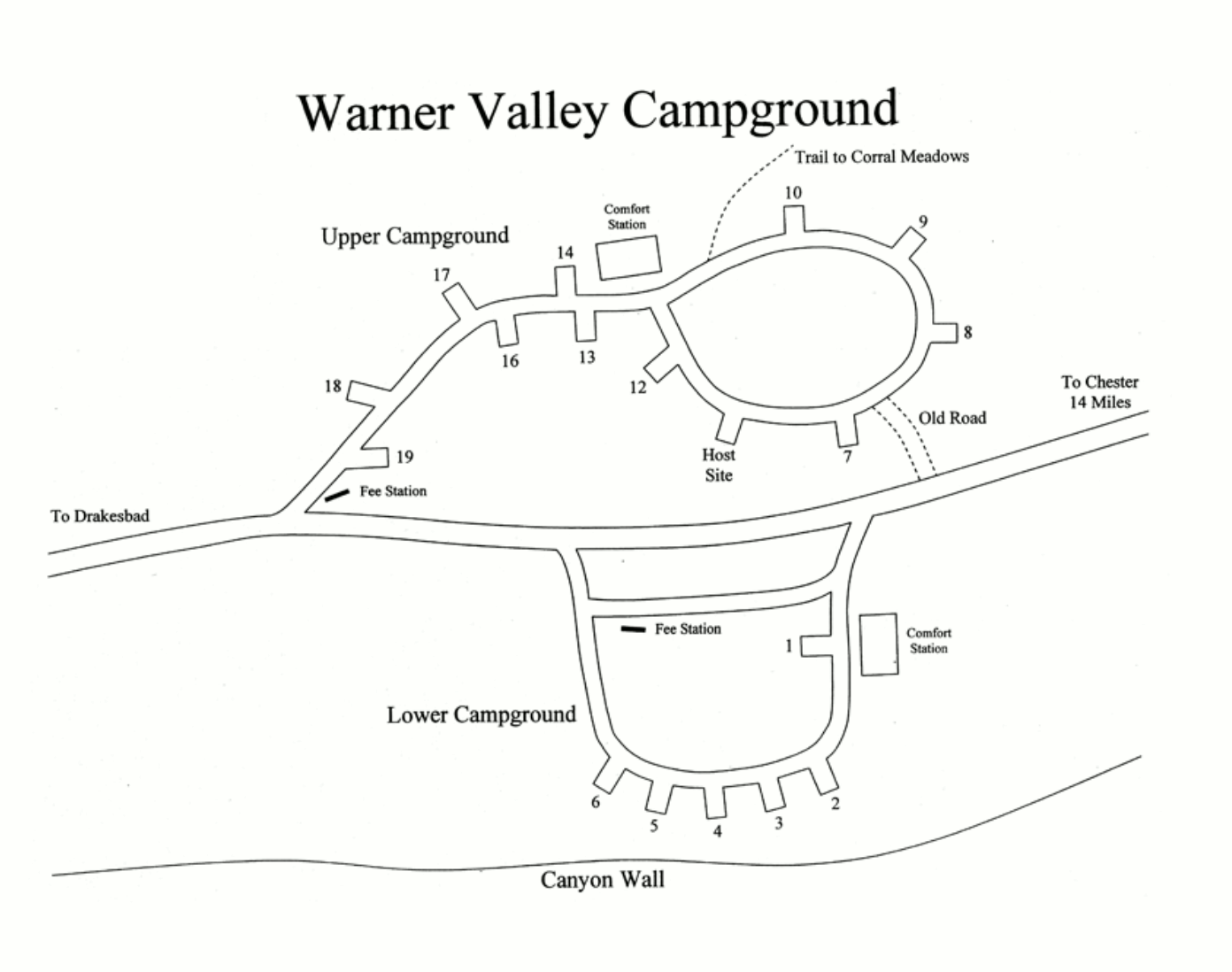
English: The remote Warner Valley Campground map is located down a rough gravel road in the southern part of the park. This map includes restrooms and trailheads. |
| Date | |
| Source | U.S. National Park Service (http://npmaps.com/wp-content/uploads/lassen-warner-valley-campground-map.gif) |
| Author | U.S. National Park Service, restoration/cleanup by Matt Holly |
Licensing
[edit]
| This image or media file contains material based on a work of a National Park Service employee, created as part of that person's official duties. As a work of the U.S. federal government, such work is in the public domain in the United States. See the NPS website and NPS copyright policy for more information. |
File history
Click on a date/time to view the file as it appeared at that time.
| Date/Time | Thumbnail | Dimensions | User | Comment | |
|---|---|---|---|---|---|
| current | 00:53, 17 May 2017 | | 1,392 × 1,098 (137 KB) | RKBot (talk | contribs) | =={{int:filedesc}}== {{Information |description= {{en|1=The remote Warner Valley Campground map is located down a rough gravel road in the southern part of the park. This map includes restrooms and trailheads.}} |date= 2015-11-10 |source= U.S. National... |
You cannot overwrite this file.
File usage on Commons
The following page uses this file:
File usage on other wikis
The following other wikis use this file:
- Usage on www.wikidata.org