File:NPS john-day-fossil-beds-blue-basin-trail-map.jpg
Jump to navigation
Jump to search

Size of this preview: 800 × 586 pixels. Other resolutions: 320 × 234 pixels | 640 × 469 pixels | 1,024 × 750 pixels | 1,190 × 872 pixels.
Original file (1,190 × 872 pixels, file size: 275 KB, MIME type: image/jpeg)
Captions
Captions
Add a one-line explanation of what this file represents
Summary
[edit]
| Description |
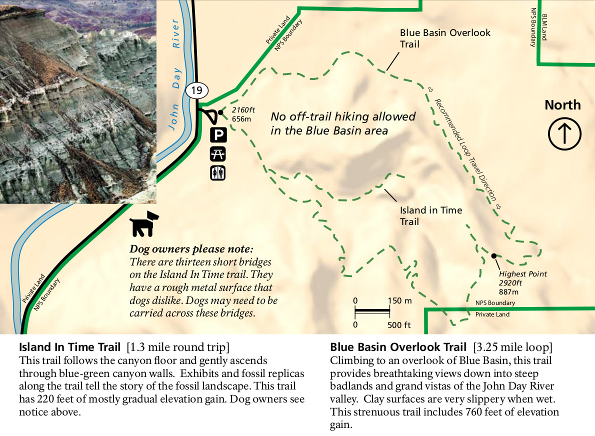
English: The Blue Basin trail map shows the Blue Basin Overlook trail and Island in Time trail, just north of the main visitor center area in the Sheep Rock unit. Here you can do a one-way or loop hike. |
| Date | |
| Source | U.S. National Park Service (http://npmaps.com/wp-content/uploads/john-day-fossil-beds-blue-basin-trail-map.jpg) |
| Author | U.S. National Park Service, restoration/cleanup by Matt Holly |
Licensing
[edit]
| This image or media file contains material based on a work of a National Park Service employee, created as part of that person's official duties. As a work of the U.S. federal government, such work is in the public domain in the United States. See the NPS website and NPS copyright policy for more information. |
File history
Click on a date/time to view the file as it appeared at that time.
| Date/Time | Thumbnail | Dimensions | User | Comment | |
|---|---|---|---|---|---|
| current | 00:19, 17 May 2017 | | 1,190 × 872 (275 KB) | RKBot (talk | contribs) | =={{int:filedesc}}== {{Information |description= {{en|1=The Blue Basin trail map shows the Blue Basin Overlook trail and Island in Time trail, just north of the main visitor center area in the Sheep Rock unit. Here you can do a one-way or loop hike.}}... |
You cannot overwrite this file.
File usage on Commons
The following page uses this file: