File:NPS indiana-dunes-great-marsh-trail-map.jpg
Jump to navigation
Jump to search

Size of this preview: 335 × 599 pixels. Other resolutions: 134 × 240 pixels | 268 × 480 pixels | 740 × 1,324 pixels.
Original file (740 × 1,324 pixels, file size: 79 KB, MIME type: image/jpeg)
Captions
Captions
Add a one-line explanation of what this file represents
Summary
[edit]
| Description |
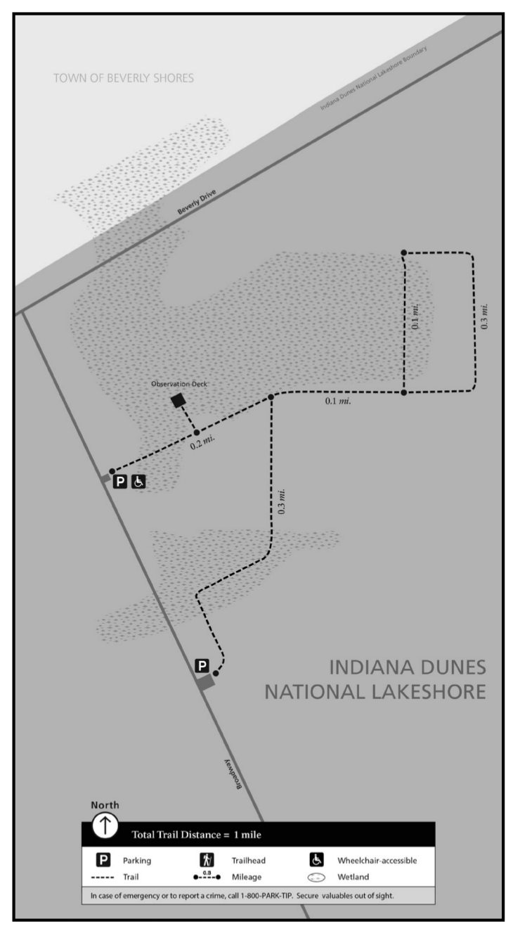
English: Great Marsh trail map, located east of the state park near the Calumet bike trail and the town of Beverly Shores. You’ll find an observation tower and two parking lots to access this trail. |
| Date | |
| Source | U.S. National Park Service (http://npmaps.com/wp-content/uploads/indiana-dunes-great-marsh-trail-map.jpg) |
| Author | U.S. National Park Service, restoration/cleanup by Matt Holly |
Licensing
[edit]
| This image or media file contains material based on a work of a National Park Service employee, created as part of that person's official duties. As a work of the U.S. federal government, such work is in the public domain in the United States. See the NPS website and NPS copyright policy for more information. |
File history
Click on a date/time to view the file as it appeared at that time.
| Date/Time | Thumbnail | Dimensions | User | Comment | |
|---|---|---|---|---|---|
| current | 23:48, 16 May 2017 | | 740 × 1,324 (79 KB) | RKBot (talk | contribs) | =={{int:filedesc}}== {{Information |description= {{en|1=Great Marsh trail map, located east of the state park near the Calumet bike trail and the town of Beverly Shores. You’ll find an observation tower and two parking lots to access this trail.}} |d... |
You cannot overwrite this file.
File usage on Commons
The following page uses this file: