File:NPS hawaii-volcanoes-geologic-map.jpg
Jump to navigation
Jump to search

Size of this preview: 800 × 546 pixels. Other resolutions: 320 × 218 pixels | 640 × 437 pixels | 1,024 × 699 pixels | 1,280 × 874 pixels | 2,560 × 1,747 pixels | 4,684 × 3,197 pixels.
Original file (4,684 × 3,197 pixels, file size: 3.76 MB, MIME type: image/jpeg)
Captions
Captions
Add a one-line explanation of what this file represents
Summary
[edit]
| Description |
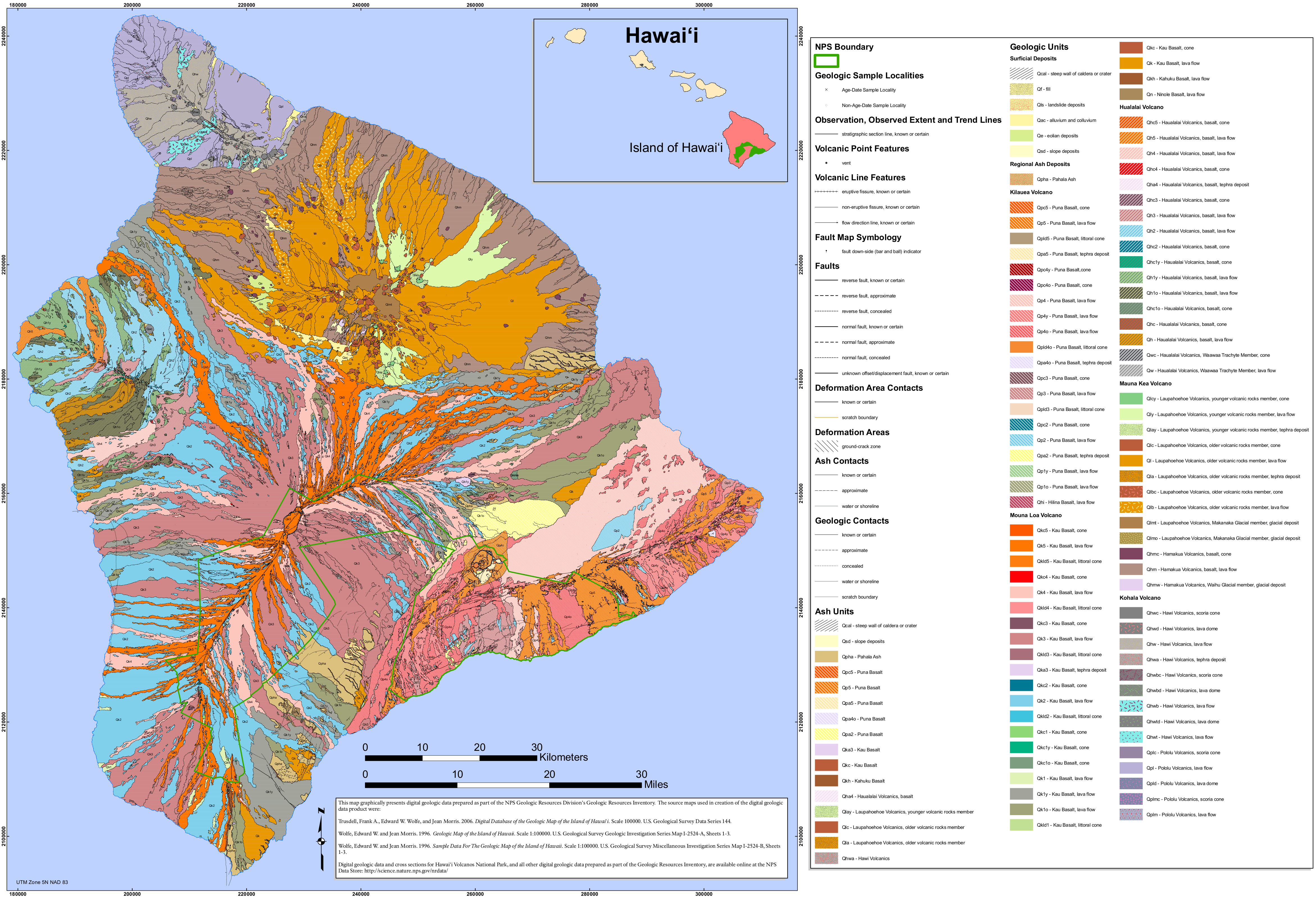
English: The Hawaii Volcanoes geologic map includes not just the lava flows and rock types on national park lands, but on the rest of the Big Island of Hawaii as well, including Kona and Hilo. |
| Date | |
| Source | U.S. National Park Service (http://npmaps.com/wp-content/uploads/hawaii-volcanoes-geologic-map.jpg) |
| Author | U.S. National Park Service, restoration/cleanup by Matt Holly |
Licensing
[edit]
| This image or media file contains material based on a work of a National Park Service employee, created as part of that person's official duties. As a work of the U.S. federal government, such work is in the public domain in the United States. See the NPS website and NPS copyright policy for more information. |
File history
Click on a date/time to view the file as it appeared at that time.
| Date/Time | Thumbnail | Dimensions | User | Comment | |
|---|---|---|---|---|---|
| current | 23:45, 16 May 2017 | | 4,684 × 3,197 (3.76 MB) | RKBot (talk | contribs) | =={{int:filedesc}}== {{Information |description= {{en|1=The Hawaii Volcanoes geologic map includes not just the lava flows and rock types on national park lands, but on the rest of the Big Island of Hawaii as well, including Kona and Hilo.}} |date= 201... |
You cannot overwrite this file.
File usage on Commons
The following 2 pages use this file: