File:NPS grand-teton-south-jenny-lake-detail-map.gif
Jump to navigation
Jump to search

Size of this preview: 480 × 599 pixels. Other resolutions: 192 × 240 pixels | 384 × 480 pixels | 615 × 768 pixels | 820 × 1,024 pixels | 1,302 × 1,626 pixels.
Original file (1,302 × 1,626 pixels, file size: 140 KB, MIME type: image/gif, 0.1 s)
Captions
Captions
Add a one-line explanation of what this file represents
Summary
[edit]
| Description |
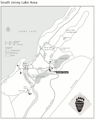
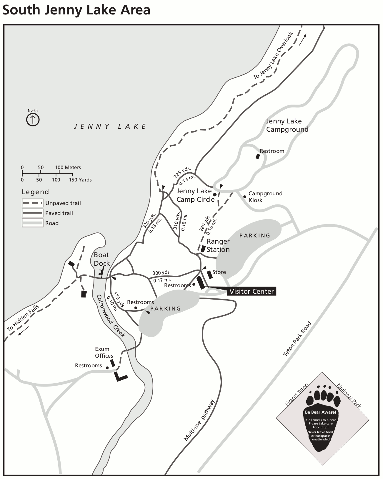
English: Jenny Lake map, zooming in on this popular area of Grand Teton National Park. Here you’ll see the visitor center, boat dock, campground, restrooms, and the various trails that depart from here. |
| Date | |
| Source | U.S. National Park Service (http://npmaps.com/wp-content/uploads/grand-teton-south-jenny-lake-detail-map.gif) |
| Author | U.S. National Park Service, restoration/cleanup by Matt Holly |
Licensing
[edit]
| This image or media file contains material based on a work of a National Park Service employee, created as part of that person's official duties. As a work of the U.S. federal government, such work is in the public domain in the United States. See the NPS website and NPS copyright policy for more information. |
File history
Click on a date/time to view the file as it appeared at that time.
| Date/Time | Thumbnail | Dimensions | User | Comment | |
|---|---|---|---|---|---|
| current | 23:22, 16 May 2017 | | 1,302 × 1,626 (140 KB) | RKBot (talk | contribs) | =={{int:filedesc}}== {{Information |description= {{en|1=Jenny Lake map, zooming in on this popular area of Grand Teton National Park. Here you’ll see the visitor center, boat dock, campground, restrooms, and the various trails that depart from here.}... |
You cannot overwrite this file.
File usage on Commons
The following 2 pages use this file:
File usage on other wikis
The following other wikis use this file:
- Usage on www.wikidata.org