File:NPS grand-teton-camping-zone-phelps-lake-map.gif
Jump to navigation
Jump to search

Size of this preview: 800 × 347 pixels. Other resolutions: 320 × 139 pixels | 640 × 277 pixels | 1,225 × 531 pixels.
Original file (1,225 × 531 pixels, file size: 71 KB, MIME type: image/gif, 0.1 s)
Captions
Captions
Add a one-line explanation of what this file represents
Summary
[edit]
| Description |
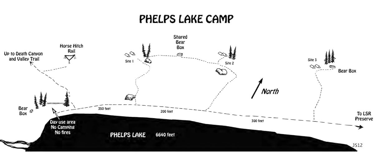
English: Map of the Phelps Lake campsite, located east of Death Canyon and Open Canyon in the southern Grand Tetons. These are individual campsites, in contrast to the dispersed zones found elsewhere. |
| Date | |
| Source | U.S. National Park Service (http://npmaps.com/wp-content/uploads/grand-teton-camping-zone-phelps-lake-map.gif) |
| Author | U.S. National Park Service, restoration/cleanup by Matt Holly |
Licensing
[edit]
| This image or media file contains material based on a work of a National Park Service employee, created as part of that person's official duties. As a work of the U.S. federal government, such work is in the public domain in the United States. See the NPS website and NPS copyright policy for more information. |
File history
Click on a date/time to view the file as it appeared at that time.
| Date/Time | Thumbnail | Dimensions | User | Comment | |
|---|---|---|---|---|---|
| current | 23:26, 16 May 2017 | | 1,225 × 531 (71 KB) | RKBot (talk | contribs) | =={{int:filedesc}}== {{Information |description= {{en|1=Map of the Phelps Lake campsite, located east of Death Canyon and Open Canyon in the southern Grand Tetons. These are individual campsites, in contrast to the dispersed zones found elsewhere.}} |d... |
You cannot overwrite this file.
File usage on Commons
The following page uses this file: