File:NPS grand-canyon-south-kaibab-trail-map.jpg
Jump to navigation
Jump to search

Size of this preview: 654 × 600 pixels. Other resolutions: 262 × 240 pixels | 523 × 480 pixels | 869 × 797 pixels.
Original file (869 × 797 pixels, file size: 153 KB, MIME type: image/jpeg)
Captions
Captions
Add a one-line explanation of what this file represents
Summary
[edit]
| Description |
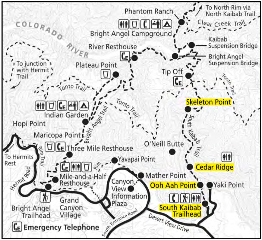
English: South Kaibab trail map, showing the popular day-hike turnaround spots. This is a more scenic descent route to the bottom of the canyon than the Bright Angel Trail, as it follows a spectacular ridge. |
| Date | |
| Source | U.S. National Park Service (http://npmaps.com/wp-content/uploads/grand-canyon-south-kaibab-trail-map.jpg) |
| Author | U.S. National Park Service, restoration/cleanup by Matt Holly |
Licensing
[edit]
| This image or media file contains material based on a work of a National Park Service employee, created as part of that person's official duties. As a work of the U.S. federal government, such work is in the public domain in the United States. See the NPS website and NPS copyright policy for more information. |
File history
Click on a date/time to view the file as it appeared at that time.
| Date/Time | Thumbnail | Dimensions | User | Comment | |
|---|---|---|---|---|---|
| current | 23:11, 16 May 2017 | | 869 × 797 (153 KB) | RKBot (talk | contribs) | =={{int:filedesc}}== {{Information |description= {{en|1=South Kaibab trail map, showing the popular day-hike turnaround spots. This is a more scenic descent route to the bottom of the canyon than the Bright Angel Trail, as it follows a spectacular ridg... |
You cannot overwrite this file.
File usage on Commons
The following page uses this file: