File:NPS grand-canyon-north-rim-cape-royal-map.jpg
Jump to navigation
Jump to search

Size of this preview: 477 × 600 pixels. Other resolutions: 191 × 240 pixels | 382 × 480 pixels | 745 × 937 pixels.
Original file (745 × 937 pixels, file size: 138 KB, MIME type: image/jpeg)
Captions
Captions
Add a one-line explanation of what this file represents
Summary
[edit]
| Description |
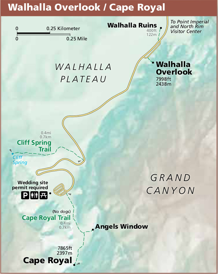
English: This North Rim Cape Royal map zooms in on Walhalla Plateau and where the road ends at Cape Royal, showing the Cape Royal Trail to Angels Window and the spectacular viewpoint. |
| Date | |
| Source | U.S. National Park Service (http://npmaps.com/wp-content/uploads/grand-canyon-north-rim-cape-royal-map.jpg) |
| Author | U.S. National Park Service, restoration/cleanup by Matt Holly |
Licensing
[edit]
| This image or media file contains material based on a work of a National Park Service employee, created as part of that person's official duties. As a work of the U.S. federal government, such work is in the public domain in the United States. See the NPS website and NPS copyright policy for more information. |
File history
Click on a date/time to view the file as it appeared at that time.
| Date/Time | Thumbnail | Dimensions | User | Comment | |
|---|---|---|---|---|---|
| current | 23:14, 16 May 2017 | | 745 × 937 (138 KB) | RKBot (talk | contribs) | =={{int:filedesc}}== {{Information |description= {{en|1=This North Rim Cape Royal map zooms in on Walhalla Plateau and where the road ends at Cape Royal, showing the Cape Royal Trail to Angels Window and the spectacular viewpoint.}} |date= 2016-05-15 |... |
You cannot overwrite this file.
File usage on Commons
The following page uses this file: