File:NPS gates-of-the-arctic-regional-map.jpg
Jump to navigation
Jump to search

Size of this preview: 677 × 599 pixels. Other resolutions: 271 × 240 pixels | 542 × 480 pixels | 986 × 873 pixels.
Original file (986 × 873 pixels, file size: 167 KB, MIME type: image/jpeg)
Captions
Captions
Add a one-line explanation of what this file represents
Summary
[edit]
| Description |
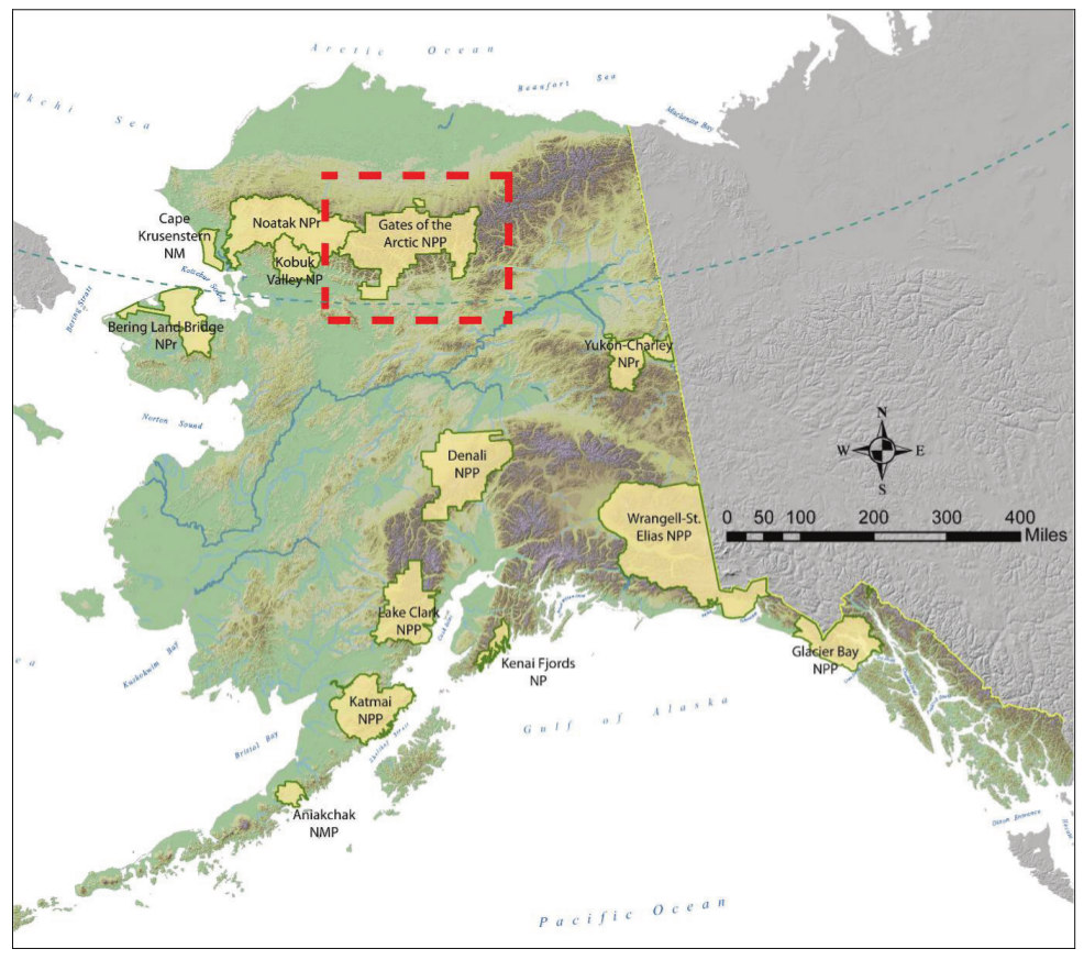
English: This regional Alaska map shows the location of Gates of the Arctic National Park compared to other national parks and preserves in Alaska. It maps elevation as well, showing Alaska’s mountain ranges. |
| Date | |
| Source | U.S. National Park Service (http://npmaps.com/wp-content/uploads/gates-of-the-arctic-regional-map.jpg) |
| Author | U.S. National Park Service, restoration/cleanup by Matt Holly |
Licensing
[edit]
| This image or media file contains material based on a work of a National Park Service employee, created as part of that person's official duties. As a work of the U.S. federal government, such work is in the public domain in the United States. See the NPS website and NPS copyright policy for more information. |
File history
Click on a date/time to view the file as it appeared at that time.
| Date/Time | Thumbnail | Dimensions | User | Comment | |
|---|---|---|---|---|---|
| current | 21:29, 16 May 2017 | | 986 × 873 (167 KB) | RKBot (talk | contribs) | =={{int:filedesc}}== {{Information |description= {{en|1=This regional Alaska map shows the location of Gates of the Arctic National Park compared to other national parks and preserves in Alaska. It maps elevation as well, showing Alaska’s mountain ra... |
You cannot overwrite this file.
File usage on Commons
The following 2 pages use this file: