File:NPS dinosaur-river-campsite-map.jpg
Jump to navigation
Jump to search

No higher resolution available.
NPS_dinosaur-river-campsite-map.jpg (688 × 392 pixels, file size: 63 KB, MIME type: image/jpeg)
Captions
Captions
Add a one-line explanation of what this file represents
Summary
[edit]
| Description |
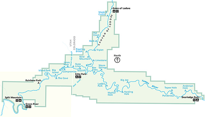
English: This river campsite map shows just the campsites accessible by water through the various canyons and bends in the Green and Yampa Rivers. This is helpful for planning your river trip! |
| Date | |
| Source | U.S. National Park Service (http://npmaps.com/wp-content/uploads/dinosaur-river-campsite-map.jpg) |
| Author | U.S. National Park Service, restoration/cleanup by Matt Holly |
Licensing
[edit]
| This image or media file contains material based on a work of a National Park Service employee, created as part of that person's official duties. As a work of the U.S. federal government, such work is in the public domain in the United States. See the NPS website and NPS copyright policy for more information. |
File history
Click on a date/time to view the file as it appeared at that time.
| Date/Time | Thumbnail | Dimensions | User | Comment | |
|---|---|---|---|---|---|
| current | 21:11, 16 May 2017 | | 688 × 392 (63 KB) | RKBot (talk | contribs) | =={{int:filedesc}}== {{Information |description= {{en|1=This river campsite map shows just the campsites accessible by water through the various canyons and bends in the Green and Yampa Rivers. This is helpful for planning your river trip!}} |date= 201... |
You cannot overwrite this file.
File usage on Commons
The following page uses this file: