File:NPS delaware-water-gap-surficial-geologic-map.jpg
Jump to navigation
Jump to search

Size of this preview: 415 × 599 pixels. Other resolutions: 166 × 240 pixels | 332 × 480 pixels | 532 × 768 pixels | 709 × 1,024 pixels | 1,419 × 2,048 pixels | 2,798 × 4,038 pixels.
Original file (2,798 × 4,038 pixels, file size: 3.67 MB, MIME type: image/jpeg)
Captions
Captions
Add a one-line explanation of what this file represents
Summary
[edit]
| Description |
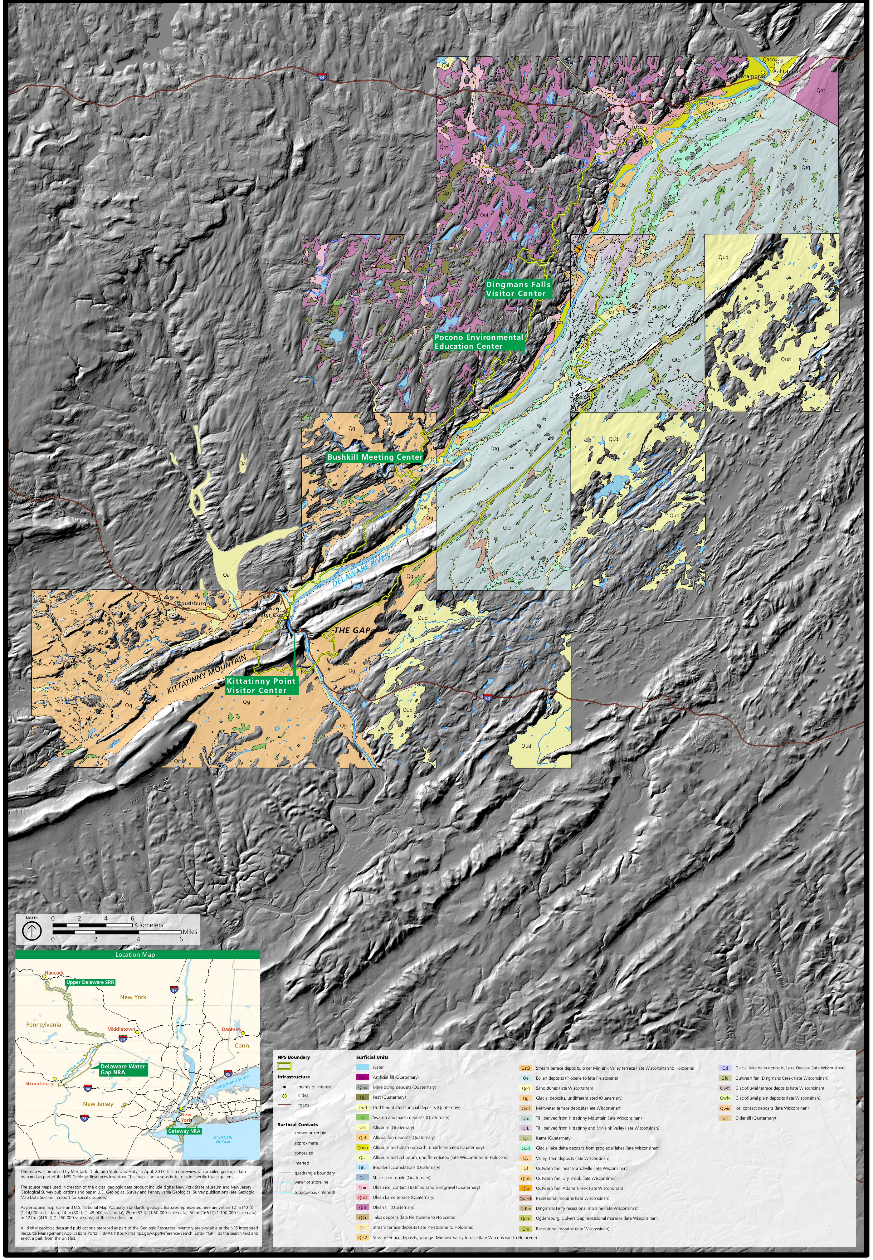
English: The surficial geology map of Delaware Water Gap shows various rock layers and geologic features in relation to roads, visitor centers, and points of interest, overlaid on a shaded terrain map. |
| Date | |
| Source | U.S. National Park Service (http://npmaps.com/wp-content/uploads/delaware-water-gap-surficial-geologic-map.jpg) |
| Author | U.S. National Park Service, restoration/cleanup by Matt Holly |
Licensing
[edit]
| This image or media file contains material based on a work of a National Park Service employee, created as part of that person's official duties. As a work of the U.S. federal government, such work is in the public domain in the United States. See the NPS website and NPS copyright policy for more information. |
File history
Click on a date/time to view the file as it appeared at that time.
| Date/Time | Thumbnail | Dimensions | User | Comment | |
|---|---|---|---|---|---|
| current | 21:03, 16 May 2017 | | 2,798 × 4,038 (3.67 MB) | RKBot (talk | contribs) | =={{int:filedesc}}== {{Information |description= {{en|1=The surficial geology map of Delaware Water Gap shows various rock layers and geologic features in relation to roads, visitor centers, and points of interest, overlaid on a shaded terrain map.}} |... |
You cannot overwrite this file.
File usage on Commons
The following page uses this file:
Categories:
- Maps of Delaware Water Gap National Recreation Area
- Geological maps of Pennsylvania
- Surface geology of the United States
- Geological maps of New Jersey
- Quaternary artificial fill in the United States
- Quaternary mine dump deposits in the United States
- Quaternary peat in the United States
- Quaternary swamp and marsh deposits in the United States
- Quaternary alluvium in the United States
- Quaternary alluvial fan deposits in the United States
- Quaternary colluvium in the United States
- Quaternary boulder fields in the United States
- Quaternary shale-chip rubble in the United States
- Quaternary glacial deposits in the United States
- Pleistocene talus in the United States
- Holocene talus in the United States
- Quaternary stream terrace deposits in the United States
- Pliocene aeolian deposits in the United States
- Pleistocene aeolian deposits in the United States
- Pleistocene sand dunes in the United States
- Quaternary meltwater terrace deposits in the United States
- Glacial deposits from the Wisconsin glaciation in the United States
- Quaternary glacial till in the United States
- Kame in the United States
- Quaternary glacial lake delta deposits in the United States
- Quaternary valley train deposits in the United States
- Quaternary outwash fans in the United States
- Recessional moraines in the United States