File:NPS cumberland-gap-geologic-map.jpg
Jump to navigation
Jump to search

Size of this preview: 800 × 550 pixels. Other resolutions: 320 × 220 pixels | 640 × 440 pixels | 1,024 × 705 pixels | 1,280 × 881 pixels | 2,443 × 1,681 pixels.
Original file (2,443 × 1,681 pixels, file size: 976 KB, MIME type: image/jpeg)
Captions
Captions
Add a one-line explanation of what this file represents
Summary
[edit]
| Description |
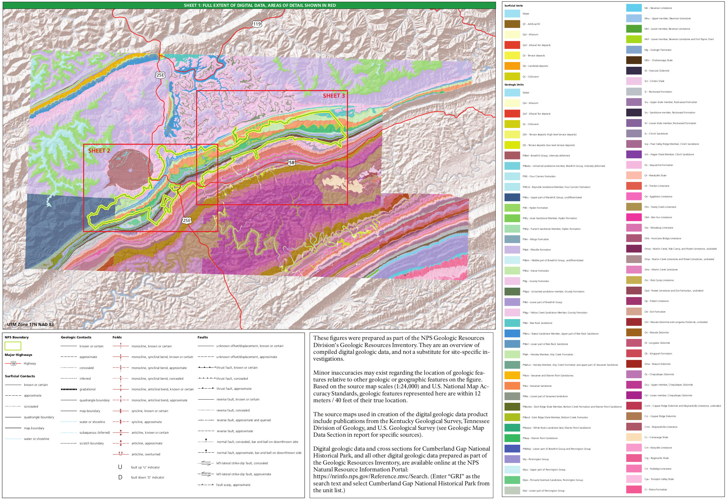
English: Geologic map of Cumberland Gap, showing an overview map and legend identifying the rock layers you’ll find in the two maps below which divide Cumberland Gap into an east and west half. |
| Date | |
| Source | U.S. National Park Service (http://npmaps.com/wp-content/uploads/cumberland-gap-geologic-map.jpg) |
| Author | U.S. National Park Service, restoration/cleanup by Matt Holly |
Licensing
[edit]
| This image or media file contains material based on a work of a National Park Service employee, created as part of that person's official duties. As a work of the U.S. federal government, such work is in the public domain in the United States. See the NPS website and NPS copyright policy for more information. |
File history
Click on a date/time to view the file as it appeared at that time.
| Date/Time | Thumbnail | Dimensions | User | Comment | |
|---|---|---|---|---|---|
| current | 20:16, 16 May 2017 | | 2,443 × 1,681 (976 KB) | RKBot (talk | contribs) | =={{int:filedesc}}== {{Information |description= {{en|1=Geologic map of Cumberland Gap, showing an overview map and legend identifying the rock layers you’ll find in the two maps below which divide Cumberland Gap into an east and west half.}} |date=... |
You cannot overwrite this file.
File usage on Commons
The following page uses this file:
Categories:
- Geological maps of Cumberland Gap National Historical Park
- Grainger Formation
- Chattanooga Shale - maps
- Clinton Group (geology) - maps
- Slade Formation - maps
- Alvy Creek Formation
- Warren Point Sandstone
- Maryville Limestone
- Quaternary artificial fill in the United States
- Quaternary alluvium in the United States
- Quaternary alluvial fan deposits in the United States
- Quaternary terrace deposits in the United States
- Quaternary landslide deposits in the United States
- Quaternary colluvium in the United States
- Breathitt Group (geology)
- Four Corners Formation (geology)
- Reynolds Sandstone Member, Four Corners Formation
- Hyden Formation
- Jense Sandstone Member, Hyden Formation
- Puckett Sandstone Member, Hyden Formation
- Mingo Formation
- Pikeville Formation
- Hance Formation
- Grundy Formation
- Yellow Creek Sandstone Member, Grundy Formation
- Bee Rock Sandstone
- Hensley Member, Alvy Creek Formation
- Sewanee Sandstone
- Naese Sandstone Member, Bee Rock Formation