File:NPS crater-lake-hazards-map.jpg
Jump to navigation
Jump to search

Size of this preview: 403 × 599 pixels. Other resolutions: 161 × 240 pixels | 323 × 480 pixels | 516 × 768 pixels | 688 × 1,024 pixels | 1,377 × 2,048 pixels | 2,565 × 3,814 pixels.
Original file (2,565 × 3,814 pixels, file size: 2.34 MB, MIME type: image/jpeg)
Captions
Captions
Add a one-line explanation of what this file represents
Summary
[edit]
| Description |
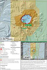
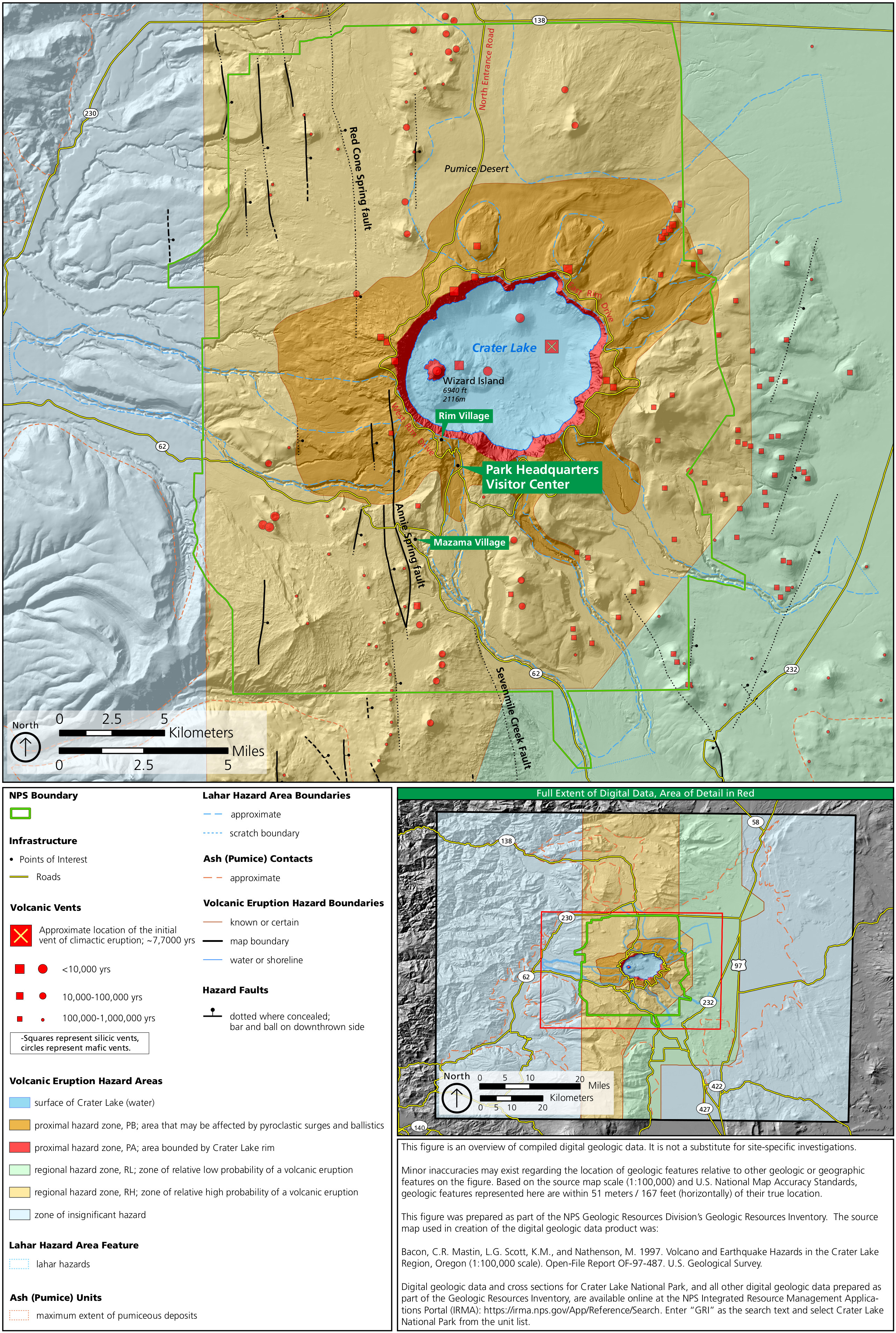
English: This geologic hazards map of Crater Lake shows both volcanic and earthquake hazards, including historical volcanic vents, earthquake fault zones, and lahar hazard areas. |
| Date | |
| Source | U.S. National Park Service (http://npmaps.com/wp-content/uploads/crater-lake-hazards-map.jpg) |
| Author | U.S. National Park Service, restoration/cleanup by Matt Holly |
Licensing
[edit]
| This image or media file contains material based on a work of a National Park Service employee, created as part of that person's official duties. As a work of the U.S. federal government, such work is in the public domain in the United States. See the NPS website and NPS copyright policy for more information. |
File history
Click on a date/time to view the file as it appeared at that time.
| Date/Time | Thumbnail | Dimensions | User | Comment | |
|---|---|---|---|---|---|
| current | 20:11, 16 May 2017 | | 2,565 × 3,814 (2.34 MB) | RKBot (talk | contribs) | =={{int:filedesc}}== {{Information |description= {{en|1=This geologic hazards map of Crater Lake shows both volcanic and earthquake hazards, including historical volcanic vents, earthquake fault zones, and lahar hazard areas.}} |date= 2017-01-12 |sourc... |
You cannot overwrite this file.
File usage on Commons
The following page uses this file:
Categories:
- Maps of Crater Lake National Park
- Geological maps of Oregon
- Topographic maps of Crater Lake National Park
- Hazard maps of volcanoes in the United States
- Crater Lake
- Volcano monitoring in Oregon
- Geological maps of Mount Mazama
- Eruptive vents of Mount Mazama-Crater Lake
- Climactic eruption of Mount Mazama
- Faults in Oregon
- Fissure vents (eruptive) in Oregon