File:NPS congaree-geologic-map-legend.jpg
Jump to navigation
Jump to search

Size of this preview: 406 × 599 pixels. Other resolutions: 162 × 240 pixels | 325 × 480 pixels | 520 × 768 pixels | 694 × 1,024 pixels | 2,138 × 3,155 pixels.
Original file (2,138 × 3,155 pixels, file size: 2.09 MB, MIME type: image/jpeg)
Captions
Captions
Add a one-line explanation of what this file represents
Summary
[edit]
| Description |
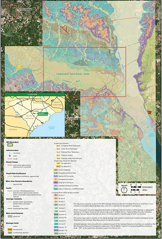
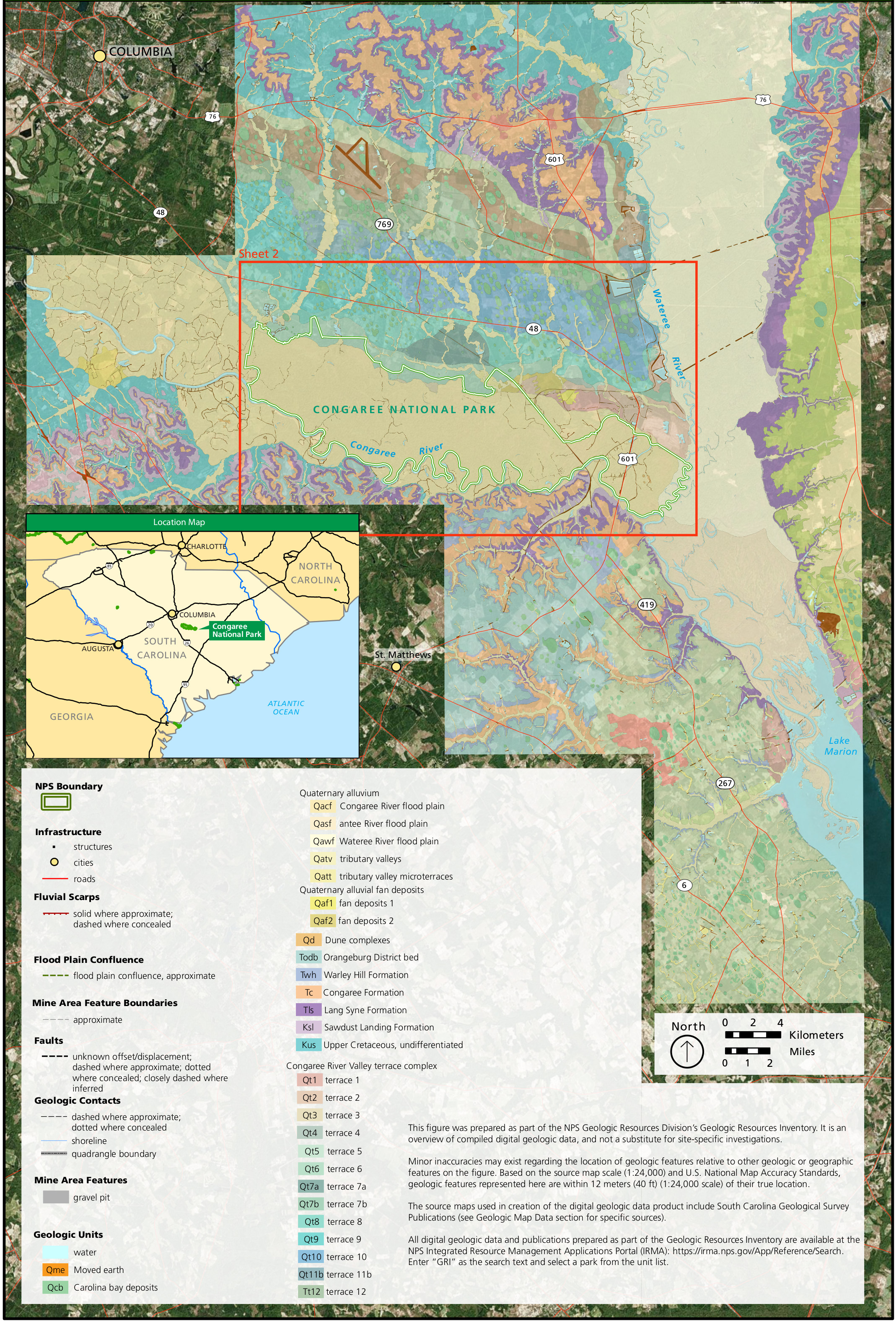
English: This geologic map of Congaree zooms out to show the surrounding area of South Carolina southeast of Columbia. It also includes a legend labeling each rock type in the map above. |
| Date | |
| Source | U.S. National Park Service (http://npmaps.com/wp-content/uploads/congaree-geologic-map-legend.jpg) |
| Author | U.S. National Park Service, restoration/cleanup by Matt Holly |
Licensing
[edit]
| This image or media file contains material based on a work of a National Park Service employee, created as part of that person's official duties. As a work of the U.S. federal government, such work is in the public domain in the United States. See the NPS website and NPS copyright policy for more information. |
File history
Click on a date/time to view the file as it appeared at that time.
| Date/Time | Thumbnail | Dimensions | User | Comment | |
|---|---|---|---|---|---|
| current | 20:09, 16 May 2017 | | 2,138 × 3,155 (2.09 MB) | RKBot (talk | contribs) | =={{int:filedesc}}== {{Information |description= {{en|1=This geologic map of Congaree zooms out to show the surrounding area of South Carolina southeast of Columbia. It also includes a legend labeling each rock type in the map above.}} |date= 2017-01-1... |
You cannot overwrite this file.
File usage on Commons
The following page uses this file:
Categories:
- Geological maps of Congaree National Park
- Geological maps of South Carolina
- Congaree River floodpain
- Wateree River floodplain
- Gravel pits in South Carolina
- Carolina Bay deposits (Quaternary)
- Antee River floodplain
- Quaternary tributary valleys in South Carolina
- Quaternary tributary valley microterraces in South Carolina
- Quaternary alluvial fan deposits in South Carolina
- Quaternary dune complexes in South Carolina
- Orangeburg District Bed
- Warley Hill Formation
- Congaree Formation
- Lang Syne Formation
- Sawdust Landing Formation
- Cretaceous rocks in South Carolina
- Congaree River Valley terrace complex