File:NPS buffalo-erbie-ozark-trail-map.jpg
Jump to navigation
Jump to search

Size of this preview: 800 × 527 pixels. Other resolutions: 320 × 211 pixels | 640 × 422 pixels | 1,024 × 675 pixels | 1,280 × 843 pixels | 2,392 × 1,576 pixels.
Original file (2,392 × 1,576 pixels, file size: 1.11 MB, MIME type: image/jpeg)
Captions
Captions
Add a one-line explanation of what this file represents
Summary
[edit]
| Description |
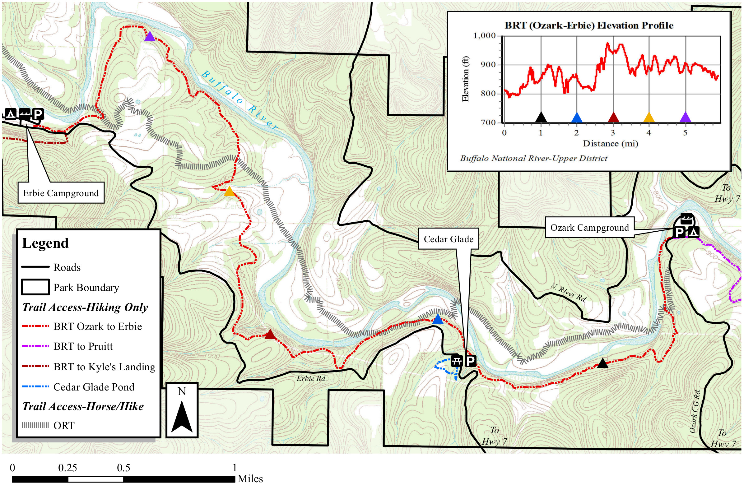
English: This Erbie to Ozark map shows this segment of the trail from Erbie Campground to Ozark Campground, via Cedar Glade. This is a pretty flat stretch, with only minor up-and-downs and no major hills. |
| Date | |
| Source | U.S. National Park Service (http://npmaps.com/wp-content/uploads/buffalo-erbie-ozark-trail-map.jpg) |
| Author | U.S. National Park Service, restoration/cleanup by Matt Holly |
Licensing
[edit]
| This image or media file contains material based on a work of a National Park Service employee, created as part of that person's official duties. As a work of the U.S. federal government, such work is in the public domain in the United States. See the NPS website and NPS copyright policy for more information. |
File history
Click on a date/time to view the file as it appeared at that time.
| Date/Time | Thumbnail | Dimensions | User | Comment | |
|---|---|---|---|---|---|
| current | 19:41, 16 May 2017 | | 2,392 × 1,576 (1.11 MB) | RKBot (talk | contribs) | =={{int:filedesc}}== {{Information |description= {{en|1=This Erbie to Ozark map shows this segment of the trail from Erbie Campground to Ozark Campground, via Cedar Glade. This is a pretty flat stretch, with only minor up-and-downs and no major hills.}... |
You cannot overwrite this file.
File usage on Commons
The following page uses this file: