File:NPS buffalo-cecil-cove-trail-map.jpg
Jump to navigation
Jump to search

Size of this preview: 800 × 525 pixels. Other resolutions: 320 × 210 pixels | 640 × 420 pixels | 1,024 × 673 pixels | 1,352 × 888 pixels.
Original file (1,352 × 888 pixels, file size: 427 KB, MIME type: image/jpeg)
Captions
Captions
Add a one-line explanation of what this file represents
Summary
[edit]
| Description |
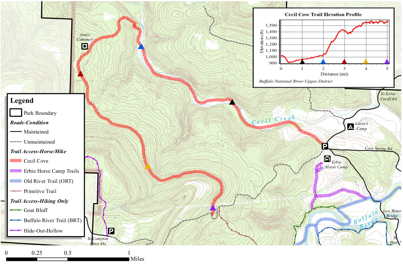
English: This Cecil Cove trail map shows this route that crosses Cecil Creek several times and passes historic sites and homesteads. You’ll find the trailhead near Caver’s Camp and Erbie Horse Camp. |
| Date | |
| Source | U.S. National Park Service (http://npmaps.com/wp-content/uploads/buffalo-cecil-cove-trail-map.jpg) |
| Author | U.S. National Park Service, restoration/cleanup by Matt Holly |
Licensing
[edit]
| This image or media file contains material based on a work of a National Park Service employee, created as part of that person's official duties. As a work of the U.S. federal government, such work is in the public domain in the United States. See the NPS website and NPS copyright policy for more information. |
File history
Click on a date/time to view the file as it appeared at that time.
| Date/Time | Thumbnail | Dimensions | User | Comment | |
|---|---|---|---|---|---|
| current | 19:42, 16 May 2017 | | 1,352 × 888 (427 KB) | RKBot (talk | contribs) | =={{int:filedesc}}== {{Information |description= {{en|1=This Cecil Cove trail map shows this route that crosses Cecil Creek several times and passes historic sites and homesteads. You’ll find the trailhead near Caver’s Camp and Erbie Horse Camp.}}... |
You cannot overwrite this file.
File usage on Commons
The following page uses this file: