File:NPS blue-ridge-parkway-peaks-of-otter-campground-map.jpg
Jump to navigation
Jump to search

Size of this preview: 457 × 599 pixels. Other resolutions: 183 × 240 pixels | 366 × 480 pixels | 586 × 768 pixels | 1,025 × 1,343 pixels.
Original file (1,025 × 1,343 pixels, file size: 174 KB, MIME type: image/jpeg)
Captions
Captions
Add a one-line explanation of what this file represents
Summary
[edit]
| Description |
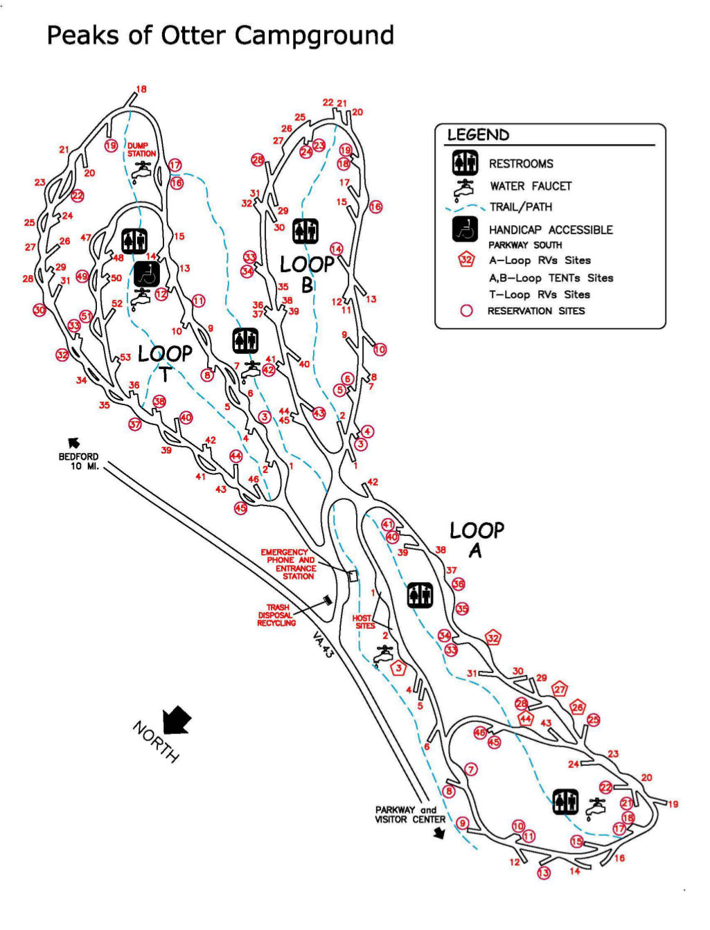
English: Peaks of Otter Campground map, located about 85 miles south along the Blue Ridge Parkway. This campground has both tent-only and RV-only loops. |
| Date | |
| Source | U.S. National Park Service (http://npmaps.com/wp-content/uploads/blue-ridge-parkway-peaks-of-otter-campground-map.jpg) |
| Author | U.S. National Park Service, restoration/cleanup by Matt Holly |
Licensing
[edit]
| This image or media file contains material based on a work of a National Park Service employee, created as part of that person's official duties. As a work of the U.S. federal government, such work is in the public domain in the United States. See the NPS website and NPS copyright policy for more information. |
File history
Click on a date/time to view the file as it appeared at that time.
| Date/Time | Thumbnail | Dimensions | User | Comment | |
|---|---|---|---|---|---|
| current | 16:37, 16 May 2017 | | 1,025 × 1,343 (174 KB) | RKBot (talk | contribs) | =={{int:filedesc}}== {{Information |description= {{en|1=Peaks of Otter Campground map, located about 85 miles south along the Blue Ridge Parkway. This campground has both tent-only and RV-only loops.}} |date= 2015-08-23 |source= U.S. National Park Serv... |
You cannot overwrite this file.
File usage on Commons
The following page uses this file: