File:NPS blue-ridge-crabtree-falls-campground-map.jpg
Jump to navigation
Jump to search

Size of this preview: 800 × 579 pixels. Other resolutions: 320 × 232 pixels | 640 × 463 pixels | 1,024 × 741 pixels | 1,280 × 927 pixels | 1,753 × 1,269 pixels.
Original file (1,753 × 1,269 pixels, file size: 509 KB, MIME type: image/jpeg)
Captions
Captions
Add a one-line explanation of what this file represents
Summary
[edit]
| Description |
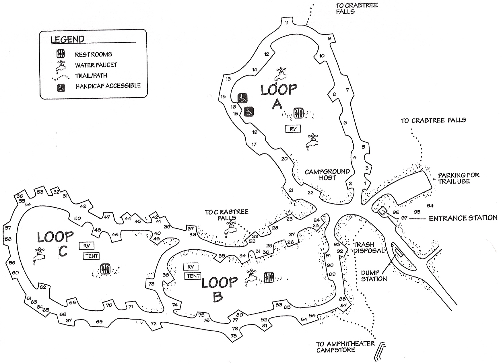
English: Crabtree Falls Campground map, located near mile 340 of the Blue Ridge Parkway and is nearest Mount Mitchell State Park. You can hike from your campsite directly to Crabtree Falls. |
| Date | |
| Source | U.S. National Park Service (http://npmaps.com/wp-content/uploads/blue-ridge-crabtree-falls-campground-map.jpg) |
| Author | U.S. National Park Service, restoration/cleanup by Matt Holly |
Licensing
[edit]
| This image or media file contains material based on a work of a National Park Service employee, created as part of that person's official duties. As a work of the U.S. federal government, such work is in the public domain in the United States. See the NPS website and NPS copyright policy for more information. |
File history
Click on a date/time to view the file as it appeared at that time.
| Date/Time | Thumbnail | Dimensions | User | Comment | |
|---|---|---|---|---|---|
| current | 16:38, 16 May 2017 | | 1,753 × 1,269 (509 KB) | RKBot (talk | contribs) | =={{int:filedesc}}== {{Information |description= {{en|1=Crabtree Falls Campground map, located near mile 340 of the Blue Ridge Parkway and is nearest Mount Mitchell State Park. You can hike from your campsite directly to Crabtree Falls.}} |date= 2015-0... |
You cannot overwrite this file.
File usage on Commons
The following page uses this file: