File:NORAD Region-Sector Map.jpg
Jump to navigation
Jump to search
No higher resolution available.
NORAD_Region-Sector_Map.jpg (591 × 476 pixels, file size: 54 KB, MIME type: image/jpeg)
Captions
Captions
Add a one-line explanation of what this file represents


Summary
[edit]
| Description |
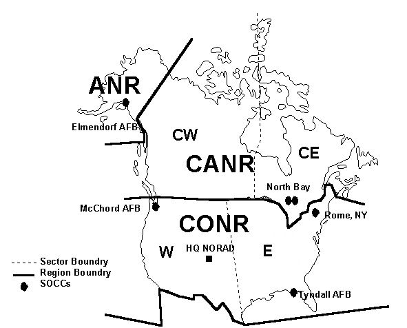
English: NORAD Region/Sector Map |
| Date | |
| Source | http://www.NORAD.mil[clarification needed] |
| Author | United States Air Force |
| Permission (Reusing this file) |
USGOV-PD |
Licensing
[edit]
This image or file is a work of a U.S. Air Force Airman or employee, taken or made as part of that person's official duties. As a work of the U.S. federal government, the image or file is in the public domain in the United States.
|
 |
File history
Click on a date/time to view the file as it appeared at that time.
| Date/Time | Thumbnail | Dimensions | User | Comment | |
|---|---|---|---|---|---|
| current | 20:43, 18 February 2011 | | 591 × 476 (54 KB) | Bwmoll3 (talk | contribs) | removed title |
| 20:41, 18 February 2011 |  | 726 × 537 (67 KB) | Bwmoll3 (talk | contribs) | {{Information |Description ={{en|1=NORAD Region/Sector Map}} |Source =http://www.NORAD.mil |Author =United States Air Force |Date =2009 |Permission =USGOV-PD |other_versions = }} |
You cannot overwrite this file.
File usage on Commons
There are no pages that use this file.
File usage on other wikis
The following other wikis use this file:
- Usage on en.wikipedia.org
- Usage on fa.wikipedia.org
- Usage on he.wikipedia.org
- Usage on hu.wikipedia.org
- Usage on ja.wikipedia.org
- Usage on sk.wikipedia.org
- Usage on zh.wikipedia.org