File:NCAD, central information point, and map.jpg
Jump to navigation
Jump to search

Size of this preview: 800 × 600 pixels. Other resolutions: 320 × 240 pixels | 640 × 480 pixels | 1,024 × 768 pixels | 1,280 × 960 pixels | 2,560 × 1,920 pixels | 4,032 × 3,024 pixels.
Original file (4,032 × 3,024 pixels, file size: 2.22 MB, MIME type: image/jpeg)
Captions
Captions
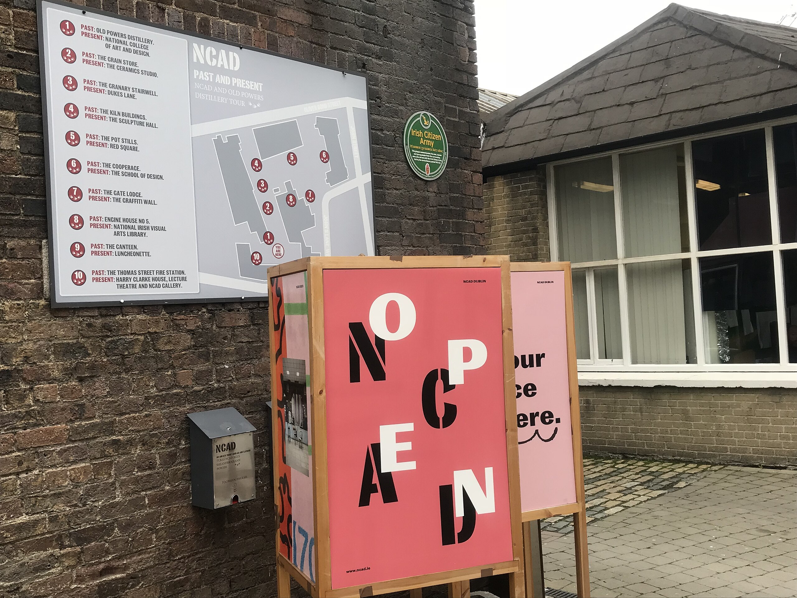
Information point and complex map inside the main entrance of the National College of Art and Design, Dublin
Summary
[edit]
| Description |
English: An information point and map inside the National College of Art and Design, Dublin, facing the main entrance arch, on the gable wall of the former Powers Distillery main building. The map details the current buildings and the former purposes of the buildings, or in the case of the former cooperage, the preceding building. |
| Date | |
| Source | Own work |
| Author | Twilson r |
| Camera location | | View this and other nearby images on: OpenStreetMap |
|---|
Licensing
[edit]
I, the copyright holder of this work, hereby publish it under the following license:
This file is licensed under the Creative Commons Attribution-Share Alike 4.0 International license.
- You are free:
- to share – to copy, distribute and transmit the work
- to remix – to adapt the work
- Under the following conditions:
- attribution – You must give appropriate credit, provide a link to the license, and indicate if changes were made. You may do so in any reasonable manner, but not in any way that suggests the licensor endorses you or your use.
- share alike – If you remix, transform, or build upon the material, you must distribute your contributions under the same or compatible license as the original.
File history
Click on a date/time to view the file as it appeared at that time.
| Date/Time | Thumbnail | Dimensions | User | Comment | |
|---|---|---|---|---|---|
| current | 07:09, 12 November 2019 | | 4,032 × 3,024 (2.22 MB) | Twilson r (talk | contribs) | User created page with UploadWizard |
You cannot overwrite this file.
File usage on Commons
There are no pages that use this file.