File:NARC-4815CA , Axehead , Mesolithic (FindID 815969).jpg
Jump to navigation
Jump to search
Size of this preview: 527 × 599 pixels. Other resolutions: 211 × 240 pixels | 422 × 480 pixels | 675 × 768 pixels | 900 × 1,024 pixels | 1,801 × 2,048 pixels | 5,694 × 6,476 pixels.
Original file (5,694 × 6,476 pixels, file size: 12.05 MB, MIME type: image/jpeg)
Captions
Captions
Add a one-line explanation of what this file represents
Summary
[edit].jpg&action=edit§ion=1)
| NARC-4815CA : Axehead : Mesolithic | |||
|---|---|---|---|
| Photographer |
Northamptonshire County Council, Eleanore Cox, 2016-11-22 17:37:08 |
||
| Title |
NARC-4815CA : Axehead : Mesolithic |
||
| Description |
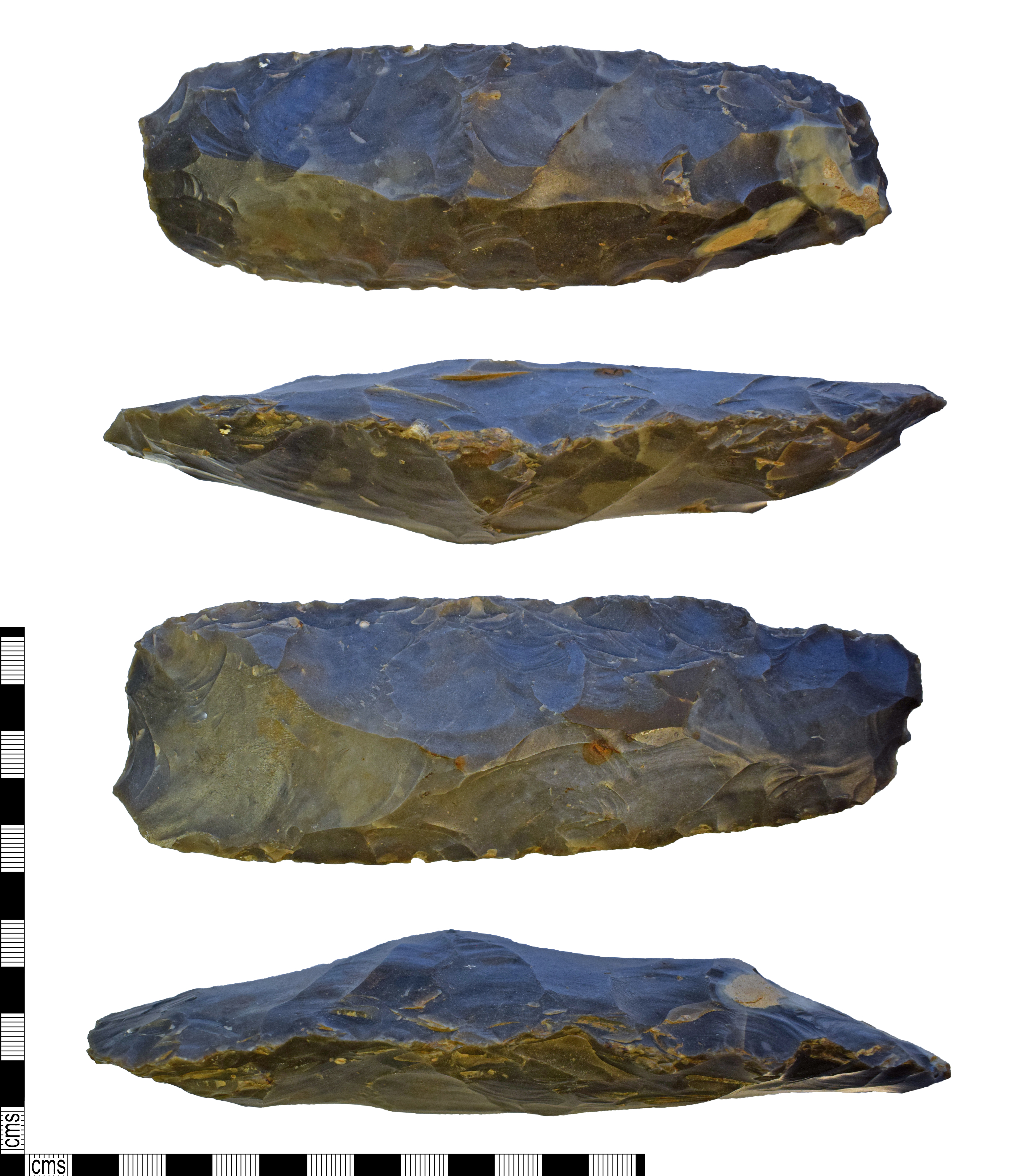
English: A complete flint Tranchet Axe of Mesolithic date (9,500-3,550 BC). The lithic is sub-rectangular in plan, long and narrow with a slightly wider blade end. The lithic is bi-convex in section creating a sub-triangular cross section due an off-centre ridge running down the centre dorsal surface. The dorsal surface has covering scaled and parallel flaking and a minor amount of retained cortex at the proximal end. All edges have semi-abrupt retouch. The ventral surface has covering scaled flaking and a large triangular transverse 'tranchet' flake has been removed from distal edge. The lithic retains a minor amount of cortex and is therefore a secondary flake.
|
||
| Depicted place | (County of findspot) Northamptonshire | ||
| Date | between 9500 BC and 3500 BC | ||
| Accession number |
FindID: 815969 Old ref: NARC-4815CA Filename: NARC4815CA.jpg |
||
| Credit line |
|
||
| Source |
https://finds.org.uk/database/ajax/download/id/591450 Catalog: https://finds.org.uk/database/images/image/id/591450/recordtype/artefacts archive copy at the Wayback Machine Artefact: https://finds.org.uk/database/artefacts/record/id/815969 |
||
| Permission (Reusing this file) |
Attribution-ShareAlike License | ||
| Object location | | View this and other nearby images on: OpenStreetMap |
|---|
.jpg¶ms=052.286800_N_-000.649921_E_globe:Earth_class:object_type:object__&language=en)
Licensing
[edit].jpg&action=edit§ion=2)
This file is licensed under the Creative Commons Attribution-Share Alike 2.0 Generic license.
Attribution: Northamptonshire County Council
- You are free:
- to share – to copy, distribute and transmit the work
- to remix – to adapt the work
- Under the following conditions:
- attribution – You must give appropriate credit, provide a link to the license, and indicate if changes were made. You may do so in any reasonable manner, but not in any way that suggests the licensor endorses you or your use.
- share alike – If you remix, transform, or build upon the material, you must distribute your contributions under the same or compatible license as the original.
File history
Click on a date/time to view the file as it appeared at that time.
| Date/Time | Thumbnail | Dimensions | User | Comment | |
|---|---|---|---|---|---|
| current | 04:27, 20 December 2018 | | 5,694 × 6,476 (12.05 MB) | Fæ (talk | contribs) | Portable Antiquities Scheme, NARC, FindID: 815969, mesolithic, page 2814, batch count 6462 |
You cannot overwrite this file.
File usage on Commons
The following page uses this file:
.jpg)
.jpg&oldid=742057932)