File:Nông Cống district location map.svg
Jump to navigation
Jump to search

Size of this PNG preview of this SVG file: 423 × 599 pixels. Other resolutions: 169 × 240 pixels | 339 × 480 pixels | 542 × 768 pixels | 723 × 1,024 pixels | 1,446 × 2,048 pixels | 1,673 × 2,369 pixels.
Original file (SVG file, nominally 1,673 × 2,369 pixels, file size: 182 KB)
Captions
Captions
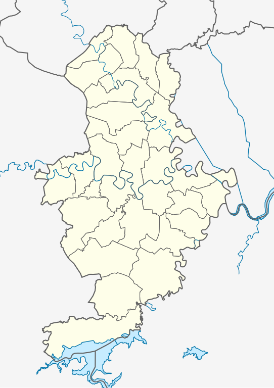
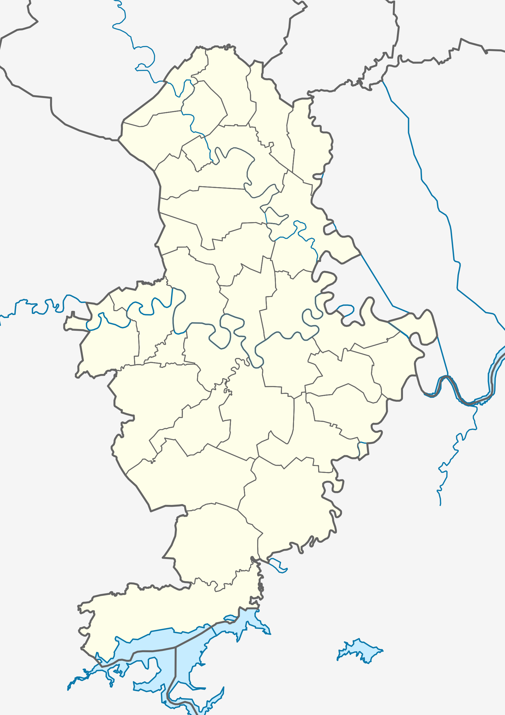
Location map of Nông Cống district
Summary
[edit]
| Description |
Tiếng Việt: Bản đồ định vị huyện Nông Cống, tỉnh Thanh Hóa. Giới hạn địa lý:
English: Location map of Nông Cống district, Thanh Hóa province. Geographic limits of the map:
|
| Date | |
| Source | Own work |
| Author | Bùi Lê Việt Cường |
Licensing
[edit]
I, the copyright holder of this work, hereby publish it under the following license:
This file is licensed under the Creative Commons Attribution-Share Alike 4.0 International license.
- You are free:
- to share – to copy, distribute and transmit the work
- to remix – to adapt the work
- Under the following conditions:
- attribution – You must give appropriate credit, provide a link to the license, and indicate if changes were made. You may do so in any reasonable manner, but not in any way that suggests the licensor endorses you or your use.
- share alike – If you remix, transform, or build upon the material, you must distribute your contributions under the same or compatible license as the original.
File history
Click on a date/time to view the file as it appeared at that time.
| Date/Time | Thumbnail | Dimensions | User | Comment | |
|---|---|---|---|---|---|
| current | 08:52, 29 August 2023 | | 1,673 × 2,369 (182 KB) | Bùi Lê Việt Cường (talk | contribs) | Uploaded own work with UploadWizard |
You cannot overwrite this file.
File usage on Commons
The following 29 pages use this file:
- File:Công Chính in Nông Cống district.svg
- File:Công Liêm in Nông Cống district.svg
- File:Hoàng Giang in Nông Cống district.svg
- File:Hoàng Sơn in Nông Cống district.svg
- File:Minh Khôi in Nông Cống district.svg
- File:Minh Nghĩa in Nông Cống district.svg
- File:Nông Cống in Nông Cống district.svg
- File:Thăng Bình in Nông Cống district.svg
- File:Thăng Long in Nông Cống district.svg
- File:Thăng Thọ in Nông Cống district.svg
- File:Trung Chính in Nông Cống district.svg
- File:Trung Thành in Nông Cống district.svg
- File:Trường Giang in Nông Cống district.svg
- File:Trường Minh in Nông Cống district.svg
- File:Trường Sơn in Nông Cống district.svg
- File:Trường Trung in Nông Cống district.svg
- File:Tân Khang in Nông Cống district.svg
- File:Tân Phúc in Nông Cống district.svg
- File:Tân Thọ in Nông Cống district.svg
- File:Tượng Lĩnh in Nông Cống district.svg
- File:Tượng Sơn in Nông Cống district.svg
- File:Tượng Văn in Nông Cống district.svg
- File:Tế Lợi in Nông Cống district.svg
- File:Tế Nông in Nông Cống district.svg
- File:Tế Thắng in Nông Cống district.svg
- File:Vạn Hòa in Nông Cống district.svg
- File:Vạn Thiện in Nông Cống district.svg
- File:Vạn Thắng in Nông Cống district.svg
- File:Yên Mỹ in Nông Cống district.svg
File usage on other wikis
The following other wikis use this file:
- Usage on vi.wikipedia.org
- Nông Cống
- Tượng Lĩnh, Nông Cống
- Bản mẫu:Đơn vị hành chính thuộc huyện Nông Cống
- Tế Nông
- Nông Cống (thị trấn)
- Hoàng Giang (xã)
- Trường Sơn, Nông Cống
- Công Chính
- Công Liêm
- Minh Khôi
- Minh Nghĩa
- Tân Khang
- Tân Phúc, Nông Cống
- Tân Thọ
- Tế Lợi
- Tế Thắng
- Thăng Long, Nông Cống
- Thăng Thọ
- Trung Chính, Nông Cống
- Trung Thành, Nông Cống
- Trường Giang, Nông Cống
- Trường Minh
- Trường Trung
- Tượng Sơn, Nông Cống
- Tượng Văn
- Vạn Hòa, Nông Cống
- Vạn Thắng, Nông Cống
- Vạn Thiện
- Yên Mỹ, Nông Cống
- Hoàng Sơn (xã)
- Thăng Bình (xã)
- Mô đun:Location map/data/Việt Nam Thanh Hóa Nông Cống
- Mô đun:Location map/data/Việt Nam Thanh Hóa Nông Cống/tài liệu
- Mô đun:Location map/data/Nông Cống