File:Myanmar location map.svg
Jump to navigation
Jump to search

Size of this PNG preview of this SVG file: 285 × 599 pixels. Other resolutions: 114 × 240 pixels | 228 × 480 pixels | 365 × 768 pixels | 487 × 1,024 pixels | 975 × 2,048 pixels | 1,200 × 2,520 pixels.
Original file (SVG file, nominally 1,200 × 2,520 pixels, file size: 633 KB)
Captions
Captions
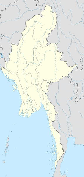
Location map of Myanmar
Summary
[edit]
| Description |
English: Location map of Myanmar. Equirectangular projection. Strechted by 105.0%. Geographic limits of the map: * N: 29.0° N * S: 9.0° N * W: 92.0° E * E: 102.0° E Made with Natural Earth. Free vector and raster map data @ naturalearthdata.com. |
| Date | |
| Source | Own work |
| Author | Uwe Dedering |
Licensing
[edit]
I, the copyright holder of this work, hereby publish it under the following licenses:
This file is licensed under the Creative Commons Attribution-Share Alike 3.0 Unported license.
- You are free:
- to share – to copy, distribute and transmit the work
- to remix – to adapt the work
- Under the following conditions:
- attribution – You must give appropriate credit, provide a link to the license, and indicate if changes were made. You may do so in any reasonable manner, but not in any way that suggests the licensor endorses you or your use.
- share alike – If you remix, transform, or build upon the material, you must distribute your contributions under the same or compatible license as the original.

|
Permission is granted to copy, distribute and/or modify this document under the terms of the GNU Free Documentation License, Version 1.2 or any later version published by the Free Software Foundation; with no Invariant Sections, no Front-Cover Texts, and no Back-Cover Texts. A copy of the license is included in the section entitled GNU Free Documentation License. |
You may select the license of your choice.
| Annotations | This image is annotated: View the annotations at Commons |
File history
Click on a date/time to view the file as it appeared at that time.
| Date/Time | Thumbnail | Dimensions | User | Comment | |
|---|---|---|---|---|---|
| current | 16:08, 29 September 2011 | | 1,200 × 2,520 (633 KB) | NordNordWest (talk | contribs) | corr, see disk |
| 17:45, 18 February 2010 |  | 1,200 × 2,520 (968 KB) | Uwe Dedering (talk | contribs) | no disputed countries | |
| 13:03, 18 February 2010 |  | 1,200 × 2,520 (974 KB) | Uwe Dedering (talk | contribs) | {{Information |Description={{en|1=Location map of Myanmar. Equirectangular projection. Strechted by 105.0%. Geographic limits of the map: * N: 29.0° N * S: 9.0° N * W: 92.0° E * E: 102.0° E Made with Natural Earth. Free vector and raster map dat |
You cannot overwrite this file.
File usage on Commons
The following 20 pages use this file:
- Commons:Graphic Lab/Map workshop/Archive/2016
- File:2024 Arakan Army offensive in Rakhine.svg
- File:Ayeyarwady Region in Myanmar.svg
- File:Bago Region in Myanmar.svg
- File:Chin State in Myanmar.svg
- File:Kachin State in Myanmar.svg
- File:Kayah State in Myanmar.svg
- File:Kayin State in Myanmar.svg
- File:Magway Region in Myanmar.svg
- File:Mandalay Region in Myanmar.svg
- File:Map of Mon Country.svg
- File:Mon State in Myanmar.svg
- File:Myanmar relief location map.jpg
- File:Naypyidaw Union Territory in Myanmar.svg
- File:Rakhine State in Myanmar.svg
- File:SAZs & SAD of Myanmar - ru.svg
- File:Sagaing Region in Myanmar.svg
- File:Shan State in Myanmar.svg
- File:Tanintharyi Region in Myanmar.svg
- File:Yangon Region in Myanmar.svg
File usage on other wikis
The following other wikis use this file:
- Usage on af.wikipedia.org
- Usage on an.wikipedia.org
- Usage on ar.wikipedia.org
- Usage on az.wikipedia.org
- Usage on ba.wikipedia.org
- Usage on be.wikipedia.org
- Usage on bg.wikipedia.org
- Usage on bh.wikipedia.org
- Usage on bn.wikipedia.org
View more global usage of this file.