File:My Public Lands Summer Road Trip- Cooper's Ferry Archaeological Site (18145320763).jpg

Original file (2,272 × 1,704 pixels, file size: 1.91 MB, MIME type: image/jpeg)
Captions
Captions
Summary
[edit].jpg&action=edit§ion=1)
| Description |
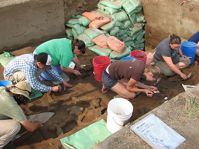
Want to learn firsthand how an archaeological dig is conducted? Each summer, Oregon State University and the BLM conduct an archaeological field school at Cooper’s Ferry just south of Cottonwood, Idaho. Cooper’s Ferry contains some of the earliest evidence of humans in the Pacific Northwest. Students from across the country have participated in this eight-week long course since 1997 and have cataloged over 30,000 items to-date. OSU Professor Dr. Loren Davis leads the field school program. His past research has shown there was human occupation of the canyon dating back to nearly 11,500 years ago. The field school is carefully uncovering layers of that history, “piecing” together generations of past uses. "We know that many people are interested in the history of the river canyon, just as we are,“ said David Sisson, BLM archaeologist who assists with the field school. “This is a unique opportunity for the public to see the excavation process and learn how the various layers of sediment provide clues to the lifestyles of previous canyon inhabitants.” Visitors are welcome to visit the dig, free of charge charge, Wednesday through Sunday from 7:30 a.m. until 3:00 p.m. This year, the course runs June 22 – August 14. Check with the local BLM office for more information. |
| Date | |
| Source | My Public Lands Summer Road Trip: Cooper's Ferry Archaeological Site |
| Author | Bureau of Land Management |
Licensing
[edit].jpg&action=edit§ion=2)
- You are free:
- to share – to copy, distribute and transmit the work
- to remix – to adapt the work
- Under the following conditions:
- attribution – You must give appropriate credit, provide a link to the license, and indicate if changes were made. You may do so in any reasonable manner, but not in any way that suggests the licensor endorses you or your use.
| This image was originally posted to Flickr by mypubliclands at https://flickr.com/photos/91981596@N06/18145320763. It was reviewed on 5 August 2015 by FlickreviewR and was confirmed to be licensed under the terms of the cc-by-2.0. |
| This image is a work of a Bureau of Land Management* employee, taken or made as part of that person's official duties. As a work of the U.S. federal government, the image is in the public domain in the United States. *or predecessor organization |
File history
Click on a date/time to view the file as it appeared at that time.
| Date/Time | Thumbnail | Dimensions | User | Comment | |
|---|---|---|---|---|---|
| current | 18:45, 4 August 2015 | | 2,272 × 1,704 (1.91 MB) | Wilfredor (talk | contribs) | Transferred from Flickr via Flickr2Commons |
You cannot overwrite this file.
File usage on Commons
There are no pages that use this file.
File usage on other wikis
The following other wikis use this file:
- Usage on es.wikipedia.org
.jpg&oldid=883928688)