File:Muskegon Shipwreck Site from Michigan City Harbor.jpg
Jump to navigation
Jump to search

Size of this preview: 800 × 450 pixels. Other resolutions: 320 × 180 pixels | 640 × 360 pixels | 1,024 × 576 pixels | 1,280 × 720 pixels | 2,816 × 1,584 pixels.
Original file (2,816 × 1,584 pixels, file size: 1.65 MB, MIME type: image/jpeg)
Captions
Captions
Add a one-line explanation of what this file represents
|
This is an image of a place or building that is listed on the National Register of Historic Places in the United States of America. Its reference number is 89000290. |
| Camera location | | View this and other nearby images on: OpenStreetMap |
|---|
| Object location | | View this and other nearby images on: OpenStreetMap |
|---|
| Description |
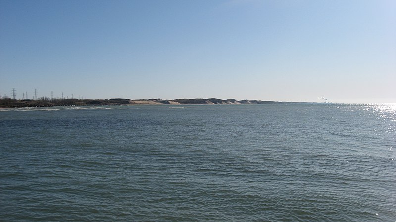
English: Looking southwest over Lake Michigan along the Indiana Dunes National Lakeshore from the walkway to the Michigan City East Light at the harbor in Michigan City, Indiana, United States. Near the center of the image, just offshore about one mile away from this picture, is the site of the shipwreck of the steamer Muskegon. The shipwreck site is an underwater archaeological site and is listed on the National Register of Historic Places. |
||
| Date | Taken on 11 April 2012 | ||
| Source | Own work | ||
| Author | Nyttend | ||
| Permission (Reusing this file) |
|
File history
Click on a date/time to view the file as it appeared at that time.
| Date/Time | Thumbnail | Dimensions | User | Comment | |
|---|---|---|---|---|---|
| current | 16:42, 26 April 2012 | | 2,816 × 1,584 (1.65 MB) | Nyttend (talk | contribs) | {{Location|41|43|42|N|86|54|37|W}} {{Object location|41|42|48|N|86|56|6|W}} {{Information |Description={{en|Looking southwest over {{w|Lake Michigan}} along the {{w|Indiana Dunes National Lakeshore}} from the walkway to the {{w|Michigan City East Light... |
You cannot overwrite this file.
File usage on Commons
The following page uses this file:
File usage on other wikis
The following other wikis use this file: