File:Mundy's map of the twin cities Edmonton & Strathcona 1911.jpg
Original file (4,724 × 4,239 pixels, file size: 4.93 MB, MIME type: image/jpeg)
Captions
Captions
Summary
[edit]
| Description |
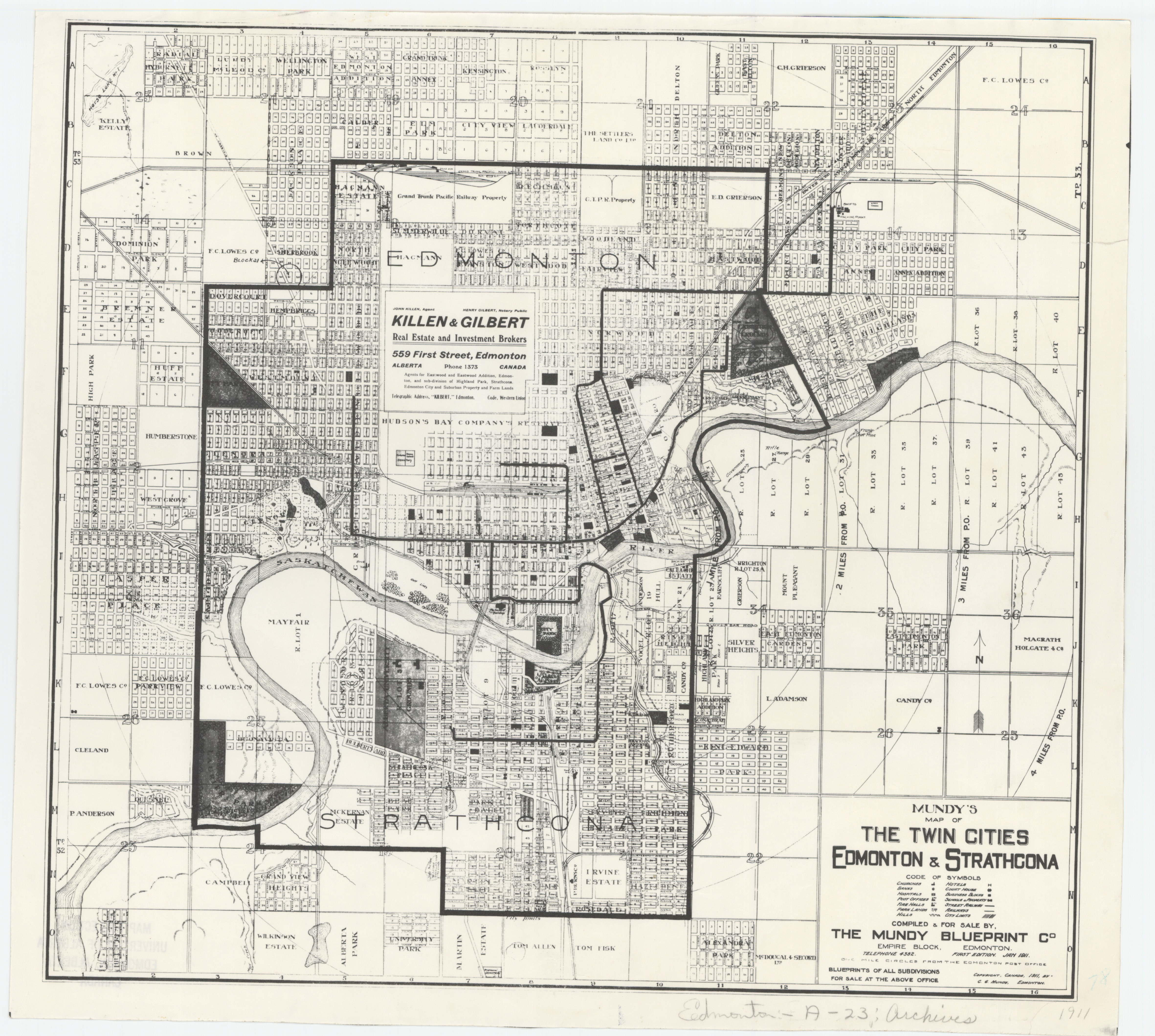
English: Mundy's map of the twin cities Edmonton & Strathcona. Edmonton: The Mundy Blueprint Co, 1911 (Jan.).
Physical description: 1 map : photocopy ; 33.3 x 36 cm. on sheet 35 x 38.6 cm. Language: English Scale: ca. 1:40,000 Symbols include churches, banks, hospitals, post offices, fire halls, park lands, hills, hotels, court house, business blocks, schools & property, street railway, railways, and city limits. Parks are coloured in green, and major roads, city limits, and other public property in red on original copy. Inset advertisement on this copy (superimposed over the H.B.C. Reserve) is for Killen & Gilbert Real Estate and Investment Brokers. Subdivisions are labelled with district names, and plots of land outside city limits labelled with owner's name. One-mile circles from the Edmonton post office shown. First edition. |
| Date | |
| Source | Peel's Prairie Provinces Map collection, a digital initiative of the University of Alberta Library. |
| Author | The Mundy Blueprint Co. |
Licensing
[edit]
This Canadian work is in the public domain in Canada because its copyright has expired due to one of the following:
it was not subject to Crown copyright, and
|
 |
File history
Click on a date/time to view the file as it appeared at that time.
| Date/Time | Thumbnail | Dimensions | User | Comment | |
|---|---|---|---|---|---|
| current | 00:03, 18 August 2020 | | 4,724 × 4,239 (4.93 MB) | Viola-Ness (talk | contribs) | Uploaded a work by The Mundy Blueprint Co. from http://peel.library.ualberta.ca/bibliography/M000057.html Peel's Prairie Provinces Map collection, a digital initiative of the University of Alberta Library. with UploadWizard |
You cannot overwrite this file.
File usage on Commons
There are no pages that use this file.