File:Mullerova mapa Cech 13-Hloupetin.jpg
Jump to navigation
Jump to search
Size of this preview: 800 × 429 pixels. Other resolutions: 320 × 172 pixels | 640 × 343 pixels | 1,024 × 550 pixels | 1,759 × 944 pixels.
Original file (1,759 × 944 pixels, file size: 1.29 MB, MIME type: image/jpeg)
Captions
Captions
Add a one-line explanation of what this file represents
Summary
[edit]
| Description |
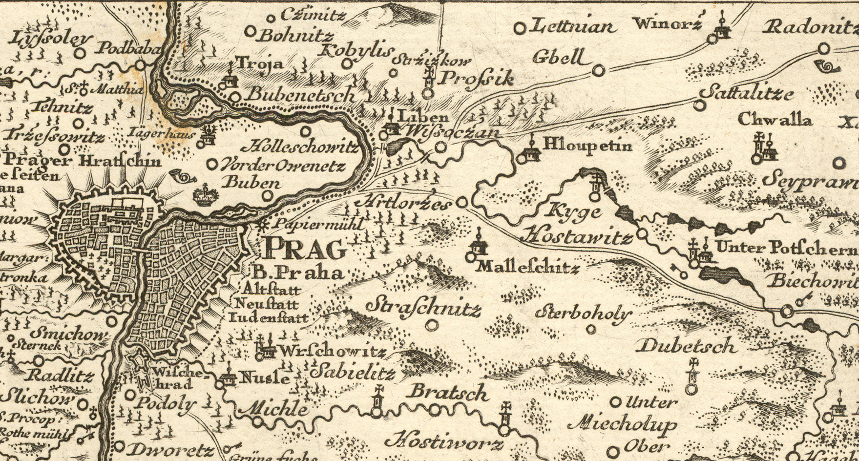
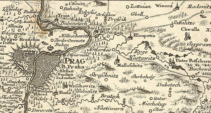
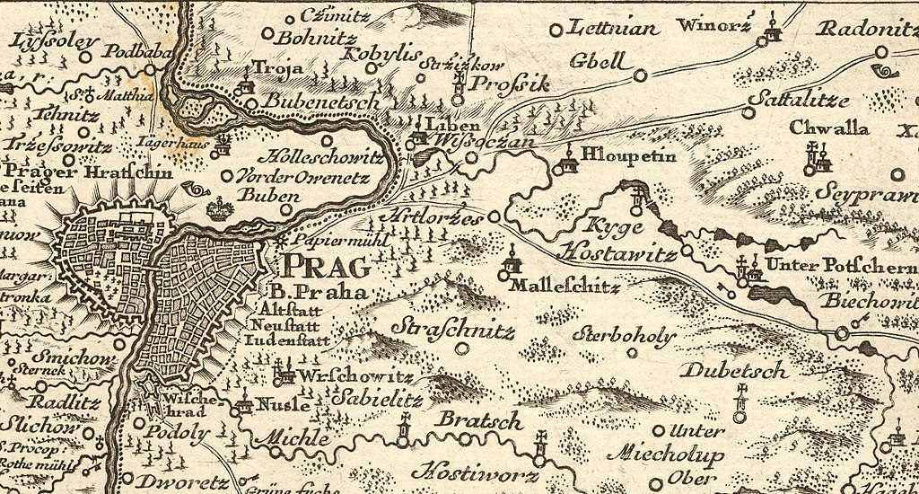
Čeština: Müllerova mapa Čech z roku 1720. Detail mapového listu č. XIII, zobrazující jihovýchodní okoli Prahy včetně obce Hloubětín. |
|||||||||||||||||||
| Date | ||||||||||||||||||||
| Source | Müllerova mapa Čech z roku 1720. Cimélie Mapové sbírky Historického ústavu AV ČR na CD-ROM | |||||||||||||||||||
| Author |
|
|||||||||||||||||||
Licensing
[edit]
|
This work is in the public domain in its country of origin and other countries and areas where the copyright term is the author's life plus 70 years or fewer. This work is in the public domain in the United States because it was published (or registered with the U.S. Copyright Office) before January 1, 1929. | |
| This file has been identified as being free of known restrictions under copyright law, including all related and neighboring rights. | |
File history
Click on a date/time to view the file as it appeared at that time.
| Date/Time | Thumbnail | Dimensions | User | Comment | |
|---|---|---|---|---|---|
| current | 13:03, 2 April 2018 | | 1,759 × 944 (1.29 MB) | Gampe (talk | contribs) | User created page with UploadWizard |
You cannot overwrite this file.
File usage on Commons
The following page uses this file:
File usage on other wikis
The following other wikis use this file:
- Usage on cs.wikipedia.org