File:Muehldorf Subcamp map EN.png
Jump to navigation
Jump to search

Size of this preview: 629 × 600 pixels. Other resolutions: 252 × 240 pixels | 503 × 480 pixels | 805 × 768 pixels | 1,074 × 1,024 pixels | 1,659 × 1,582 pixels.
Original file (1,659 × 1,582 pixels, file size: 1.31 MB, MIME type: image/png)
Captions
Captions
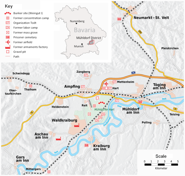
Muehldorf Subcamp map
| Description |
|
|
| Date | (UTC) | |
| Source | ||
| Author |
| This is a retouched picture, which means that it has been digitally altered from its original version. Modifications: Translated into English, moved map in the top-right corner slightly to the right to accomodate text.. The original can be viewed here: KZ Dachau - Außenkommando Mühldorf - Übersichtskarte - V2.png:
|
I, the copyright holder of this work, hereby publish it under the following license:
This file is licensed under the Creative Commons Attribution-Share Alike 2.5 Generic license.
- You are free:
- to share – to copy, distribute and transmit the work
- to remix – to adapt the work
- Under the following conditions:
- attribution – You must give appropriate credit, provide a link to the license, and indicate if changes were made. You may do so in any reasonable manner, but not in any way that suggests the licensor endorses you or your use.
- share alike – If you remix, transform, or build upon the material, you must distribute your contributions under the same or compatible license as the original.
Original upload log
[edit]
This image is a derivative work of the following images:
- File:KZ_Dachau_-_Außenkommando_Mühldorf_-_Übersichtskarte_-_V2.png licensed with Cc-by-sa-2.5
- 2008-03-16T16:05:58Z Chumwa 1659x1582 (1258271 Bytes) Auf Wunsch von [[:de:User:Tafkas|Tafkas]] zuätzliche Straßenverbindung eingefügt. Friedhofssymbol ausgetauscht.
- 2008-03-16T12:15:49Z Chumwa 1106x1055 (756121 Bytes) {{Information |Description= *{{ de }} Ehemalige Lagerkomplexe und Rüstungsanlagen im Lkr. Mühldorfund Situationsplan vom Außenkommando Mühldorf des KZ Dachau {{Template:Kartenwünsche}} |Source=Self made, based on [http:
Uploaded with derivativeFX
File history
Click on a date/time to view the file as it appeared at that time.
| Date/Time | Thumbnail | Dimensions | User | Comment | |
|---|---|---|---|---|---|
| current | 13:36, 8 January 2018 | | 1,659 × 1,582 (1.31 MB) | Hohum (talk | contribs) | Easier to pick out points of interest with colour. |
| 23:42, 14 August 2010 |  | 1,659 × 1,582 (1.39 MB) | Petropoxy (Lithoderm Proxy) (talk | contribs) | {{Information |Description=*{{ de }} Ehemalige Lagerkomplexe und Rüstungsanlagen im Lkr. Mühldorf<br />und Situationsplan vom Außenkommando Mühldorf des KZ Dachau {{Template:Kartenwünsche}} *{{ en }} Map showing the former concentration camp complex |
You cannot overwrite this file.
File usage on Commons
The following 2 pages use this file:
File usage on other wikis
The following other wikis use this file:
- Usage on en.wikipedia.org
- Usage on fr.wikipedia.org
- Usage on it.wikipedia.org