File:Mount Ichigao south foot 1964.png
Jump to navigation
Jump to search
Size of this preview: 800 × 533 pixels. Other resolutions: 320 × 213 pixels | 640 × 427 pixels | 1,024 × 683 pixels | 1,280 × 853 pixels | 2,327 × 1,551 pixels.
Original file (2,327 × 1,551 pixels, file size: 4 MB, MIME type: image/png)
Captions
Captions
Add a one-line explanation of what this file represents
Summary
[edit]
| Description |
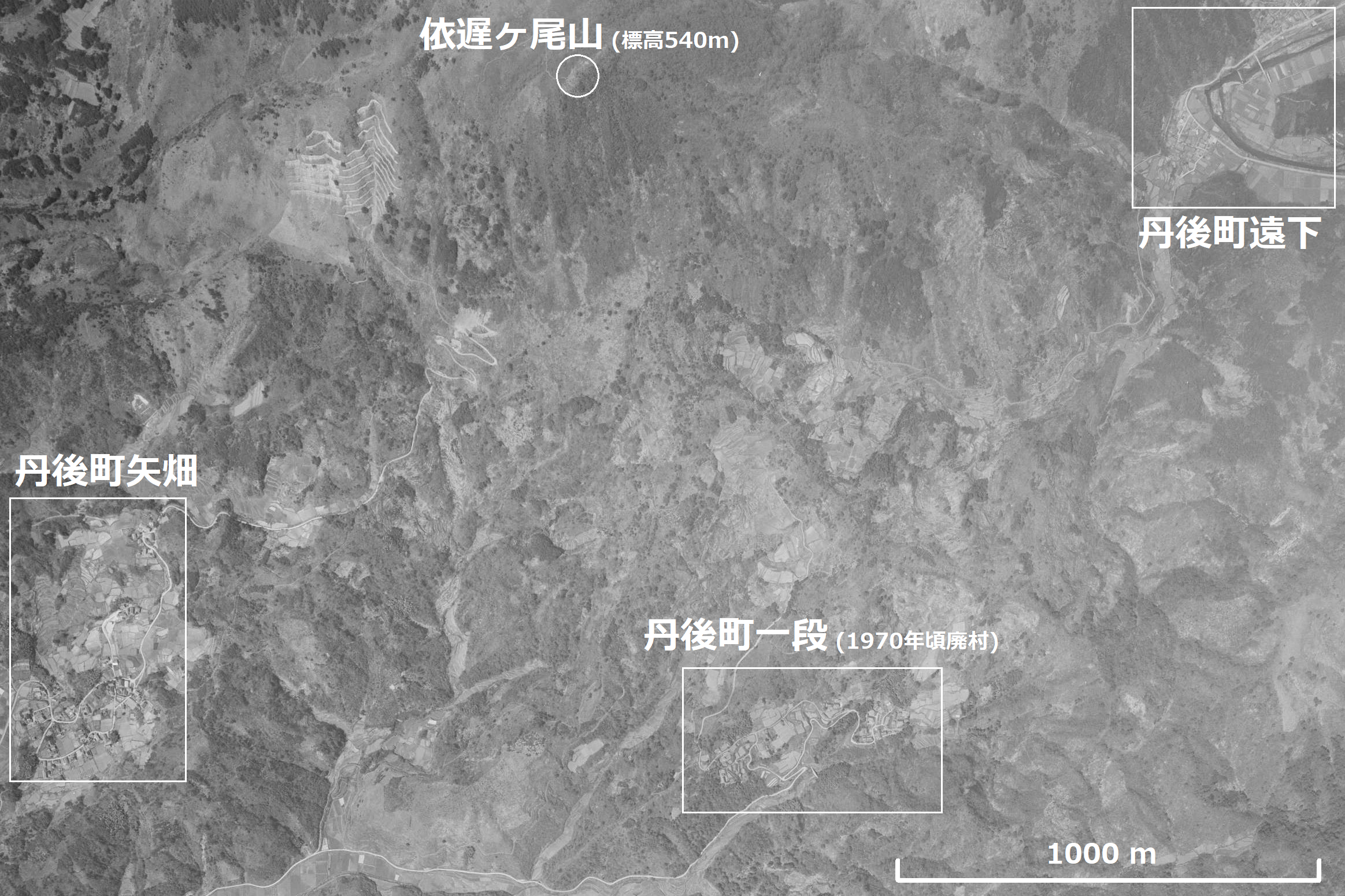
日本語: 京都府竹野郡丹後町にある依遅ケ尾山の南麓。丹後町矢畑、丹後町遠下、丹後町一段の集落。1964年。整理番号MCG641X、コース番号C3、写真番号6。 |
| Date | |
| Source | 地図・空中写真閲覧サービス |
| Author | 国土地理院 |
Licensing
[edit]

|
The copyright holder of this file, the Ministry of Land, Infrastructure, Transport and Tourism of Japan, allows anyone to use it for any purpose, provided that the copyright holder is properly attributed. Redistribution, derivative work, commercial use, and all other use is permitted. |
Attribution:
Copyright © National Land Image Information (Color Aerial Photographs), Ministry of Land, Infrastructure, Transport and Tourism
|
 |
This image is copyrighted by the Ministry of Land, Infrastructure, Transport and Tourism of Japan. For terms of use, see the stipulation to use of National Land Information (in Japanese) and message from MLIT (in Japanese and English). When you display this image on an article, include the following phrase in the description: "Made based on National Land Image Information (Color Aerial Photographs), Ministry of Land, Infrastructure, Transport and Tourism".
|
File history
Click on a date/time to view the file as it appeared at that time.
| Date/Time | Thumbnail | Dimensions | User | Comment | |
|---|---|---|---|---|---|
| current | 08:33, 18 November 2021 | | 2,327 × 1,551 (4 MB) | Asturio Cantabrio (talk | contribs) | Uploaded a work by 国土地理院 from [https://mapps.gsi.go.jp/maplibSearch.do#1 地図・空中写真閲覧サービス] with UploadWizard |
You cannot overwrite this file.
File usage on Commons
There are no pages that use this file.
File usage on other wikis
The following other wikis use this file:
- Usage on ja.wikipedia.org