File:Mount Everest from Rongbuk may 2005.JPG
Jump to navigation
Jump to search
Size of this preview: 800 × 532 pixels. Other resolutions: 320 × 213 pixels | 640 × 426 pixels | 1,024 × 681 pixels | 1,280 × 851 pixels | 3,008 × 2,000 pixels.
Original file (3,008 × 2,000 pixels, file size: 1.12 MB, MIME type: image/jpeg)
Captions
Captions
Mount Everest
Summary
[edit]
| Description |
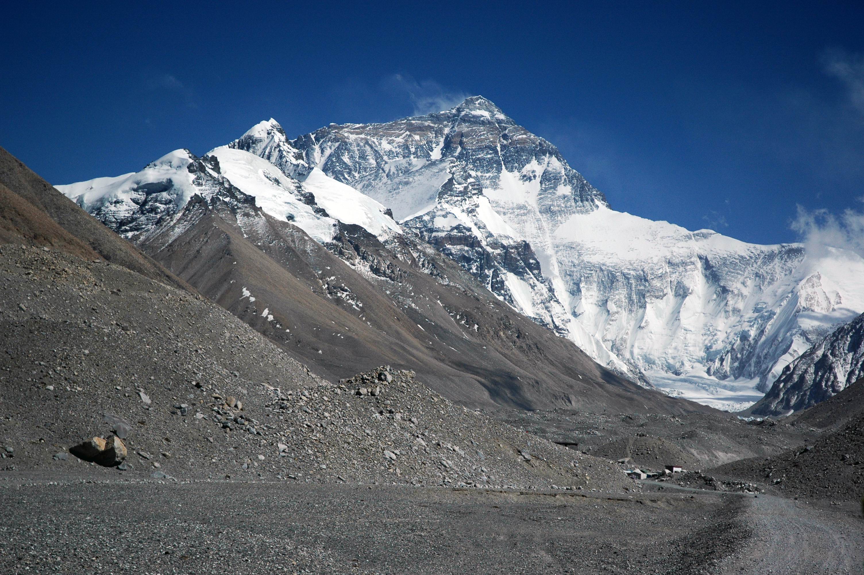
English: View of the majestic Mount Everest from the Rongbuk valley, close to base camp and the terminus of the Rongbuk glacier at 5,200m. |
| Date | 9 November 2005 (original upload date) |
| Source | No machine-readable source provided. Own work assumed (based on copyright claims). |
| Author | No machine-readable author provided. Ocrambo assumed (based on copyright claims). |
Licensing
[edit]
| I, the copyright holder of this work, release this work into the public domain. This applies worldwide. In some countries this may not be legally possible; if so: I grant anyone the right to use this work for any purpose, without any conditions, unless such conditions are required by law. |
Mt Everest seen from the Rongbuk valley, close to base camp at 5,200m.
File history
Click on a date/time to view the file as it appeared at that time.
| Date/Time | Thumbnail | Dimensions | User | Comment | |
|---|---|---|---|---|---|
| current | 12:42, 9 November 2005 | | 3,008 × 2,000 (1.12 MB) | Ocrambo (talk | contribs) | View on the majestic Mt. Everest from the Rongbuk Monastery. |
You cannot overwrite this file.
File usage on Commons
The following 2 pages use this file:
File usage on other wikis
The following other wikis use this file:
- Usage on az.wikipedia.org
- Usage on bh.wikipedia.org
- Usage on ca.wikipedia.org
- Usage on cs.wikipedia.org
- Usage on de.wikipedia.org
- Usage on dv.wikipedia.org
- Usage on en.wikipedia.org
- Environment of China
- Rongbuk Glacier
- Anatoli Boukreev
- Khumbutse
- Kula Kangri
- South Col
- North Col
- Lake Pelku
- Puma Yumco
- Tashi Dor
- Tingri Plain
- Semo La
- Diphu Pass
- Nalakankar Himal
- Molamenqing
- Labuche Kang
- User:Porsche997SBS/Images
- Ponpori Hills
- Mount Gephel
- Nagqu Town
- Zhaxi Island
- Kangmar Town
- Template:Tibet-geo-stub
- Lumajangdong Co
- Nyalam County
- Nyingchi Mainling Airport
- Laken La
- Dainkognubma
- Tanggula Mountains
- Chowa, Tibet
- Cuozheqiangma
- Damdoi
- Dêgên
- Dênggar Township
- Dobê Township
- Sangsang
- Dêlêg
View more global usage of this file.