File:Mounds nr Gwenter, Goonhilly Downs - geograph.org.uk - 886840.jpg
Jump to navigation
Jump to search
No higher resolution available.
Mounds_nr_Gwenter,_Goonhilly_Downs_-_geograph.org.uk_-_886840.jpg (640 × 368 pixels, file size: 80 KB, MIME type: image/jpeg)
Captions
Captions
Add a one-line explanation of what this file represents
Summary
[edit]
| Description |
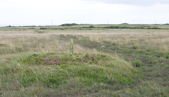
English: Mounds nr Gwenter, Goonhilly Downs There were several of these mounds in the area but, as only a few lay on the parish boundary line,
we were uncertain as to their purpose. New signage around the National Nature Reserve at nearby former radar station, RAF Dry Tree, suggests that they were actually defensive structures designed to prevent landing by glider-borne invaders in WWll. |
| Date | |
| Source | From geograph.org.uk |
| Author | Rabbi WP Thinrod |
| Attribution (required by the license) | Rabbi WP Thinrod / Mounds nr Gwenter, Goonhilly Downs / |
| Camera location | | View this and other nearby images on: OpenStreetMap |
|---|
_heading:112.00&language=en)
| Object location | | View this and other nearby images on: OpenStreetMap |
|---|
_heading:112.00&language=en)
Licensing
[edit]

|
This image was taken from the Geograph project collection. See this photograph's page on the Geograph website for the photographer's contact details. The copyright on this image is owned by Rabbi WP Thinrod and is licensed for reuse under the Creative Commons Attribution-ShareAlike 2.0 license.
|
This file is licensed under the Creative Commons Attribution-Share Alike 2.0 Generic license.
Attribution: Rabbi WP Thinrod
- You are free:
- to share – to copy, distribute and transmit the work
- to remix – to adapt the work
- Under the following conditions:
- attribution – You must give appropriate credit, provide a link to the license, and indicate if changes were made. You may do so in any reasonable manner, but not in any way that suggests the licensor endorses you or your use.
- share alike – If you remix, transform, or build upon the material, you must distribute your contributions under the same or compatible license as the original.
File history
Click on a date/time to view the file as it appeared at that time.
| Date/Time | Thumbnail | Dimensions | User | Comment | |
|---|---|---|---|---|---|
| current | 12:58, 21 February 2011 | | 640 × 368 (80 KB) | GeographBot (talk | contribs) | == {{int:filedesc}} == {{Information |description={{en|1=Mounds nr Gwenter, Goonhilly Downs There were several of these mounds in the area but, as only a few lay on the parish boundary line, we were uncertain as to their purpose. New signage around th |
You cannot overwrite this file.
File usage on Commons
There are no pages that use this file.
File usage on other wikis
The following other wikis use this file: