File:Moscow SRTM DEM exp all.png
Jump to navigation
Jump to search
Size of this preview: 460 × 600 pixels. Other resolutions: 184 × 240 pixels | 368 × 480 pixels | 589 × 768 pixels | 785 × 1,024 pixels | 2,300 × 3,000 pixels.
Original file (2,300 × 3,000 pixels, file size: 541 KB, MIME type: image/png)
Captions
Captions
Add a one-line explanation of what this file represents
Summary
[edit]
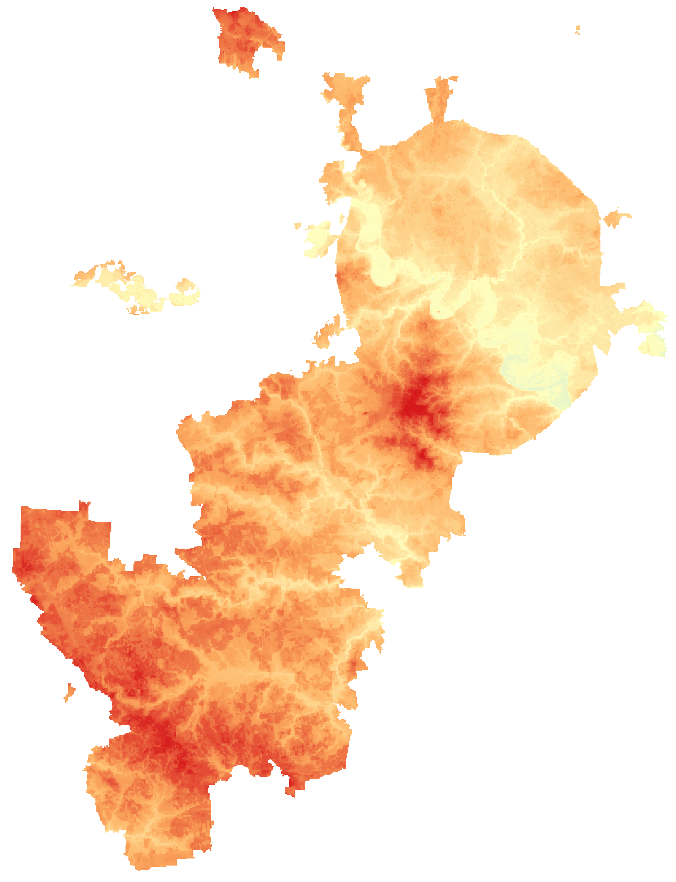
Moscow Relief Map, SRTM-1
| Description |
English: Relief map of Moscow. Data from "SRTM-1 (30m Mesh) Ver.3 2014". |
||
| Date | |||
| Source | NASA, Shuttle Radar Topography Mission (SRTM-1 "30m Mesh") | ||
| Author | User:Svetlov Artem | ||
| Permission (Reusing this file) |
|
This image uses high-resolution digital topography data from NASA's Shuttle Radar Topography Mission (SRTM) at JPL-Caltech [1]. It is in the public domain in the United States.
|
 | |
File history
Click on a date/time to view the file as it appeared at that time.
| Date/Time | Thumbnail | Dimensions | User | Comment | |
|---|---|---|---|---|---|
| current | 09:18, 21 October 2018 | | 2,300 × 3,000 (541 KB) | Svetlov Artem (talk | contribs) | Moscow Relief Map, SRTM-1 {{Information |Description= {{en|Relief map of Moscow. Data from "SRTM-1 (30m Mesh) Ver.3 2014".}} |Source=NASA, [http://www2.jpl.nasa.gov/srtm/ Shuttle Radar Topography Mission] (SRTM-1 "30m Mesh") |Author=User:Svetlov Artem |Date=2018-10-21 |Permission={{PD-self}} |other_versions= }} {{PD-USGov-NASA-SRTM}} |
You cannot overwrite this file.
File usage on Commons
The following 3 pages use this file:
File usage on other wikis
The following other wikis use this file:
- Usage on ru.wikipedia.org
- Usage on www.wikidata.org