File:More major floods in New South Wales, Australia.jpg
Original file (4,008 × 2,543 pixels, file size: 9.04 MB, MIME type: image/jpeg)
Captions
Captions
Summary
[edit]
| Description |
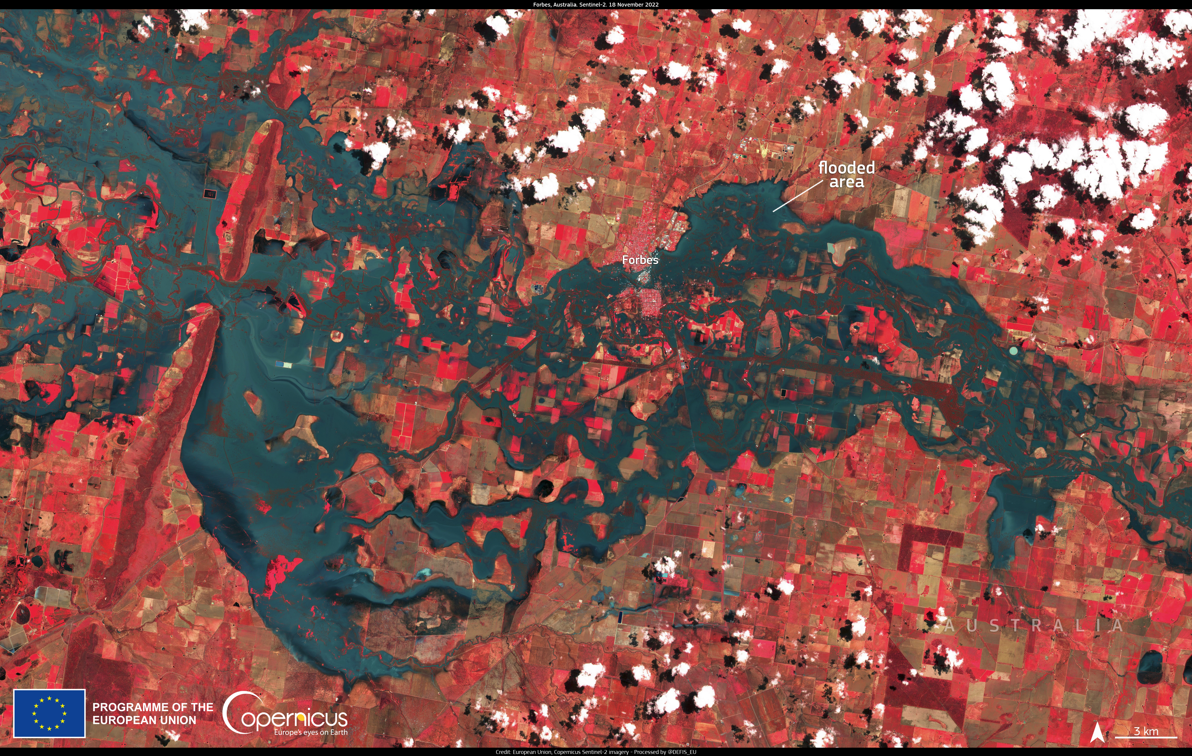
English: Severe floods continue to plague New South Wales (NSW) in Australia. The west of the state’s central area is affected by the worst flooding in 70 years. The magnitude of the floods is so important that the Ministry of Agriculture has indicated that they will affect commodity prices on the Australian continent. One of the towns that has suffered the worst damage is Forbes, shown in this image acquired by one of the Copernicus Sentinel-2 satellites on 18 November 2022. Data acquired by the Copernicus Sentinel satellite allow us to monitor the development of disasters worldwide and to estimate the extent of the affected areas. |
| Date | 21 November 2022 (upload date) |
| Source | More major floods in New South Wales, Australia |
| Author | European Union, Copernicus Sentinel-2 imagery |
Licensing
[edit]

|
This image contains data from a satellite in the Copernicus Programme, such as Sentinel-1, Sentinel-2 or Sentinel-3. Attribution is required when using this image.
Attribution: Contains modified Copernicus Sentinel data 2022
The use of Copernicus Sentinel Data is regulated under EU law (Commission Delegated Regulation (EU) No 1159/2013 and Regulation (EU) No 377/2014). Relevant excerpts:
Free access shall be given to GMES dedicated data [...] made available through GMES dissemination platforms [...].
Access to GMES dedicated data [...] shall be given for the purpose of the following use in so far as it is lawful:
GMES dedicated data [...] may be used worldwide without limitations in time.
GMES dedicated data and GMES service information are provided to users without any express or implied warranty, including as regards quality and suitability for any purpose. |
File history
Click on a date/time to view the file as it appeared at that time.
| Date/Time | Thumbnail | Dimensions | User | Comment | |
|---|---|---|---|---|---|
| current | 15:52, 2 August 2023 | | 4,008 × 2,543 (9.04 MB) | OptimusPrimeBot (talk | contribs) | #Spacemedia - Upload of https://www.copernicus.eu/system/files/2022-11/image_day/20221121_ForbesFloods.jpeg via Commons:Spacemedia |
You cannot overwrite this file.
File usage on Commons
There are no pages that use this file.