File:Moorea Island crop from Admiralty Chart No 1382 South Pacific Ocean, Society Islands. Tahiti and Moorea (Otaheitʹe and Eimeo) Harbours and anchorages on the north coast of Tahiti, Published 1880.jpg
Jump to navigation
Jump to search
Size of this preview: 612 × 600 pixels. Other resolutions: 245 × 240 pixels | 490 × 480 pixels | 784 × 768 pixels | 1,045 × 1,024 pixels | 2,316 × 2,270 pixels.
Original file (2,316 × 2,270 pixels, file size: 1.51 MB, MIME type: image/jpeg)
Captions
Captions
Add a one-line explanation of what this file represents
Summary
[edit]| Description |
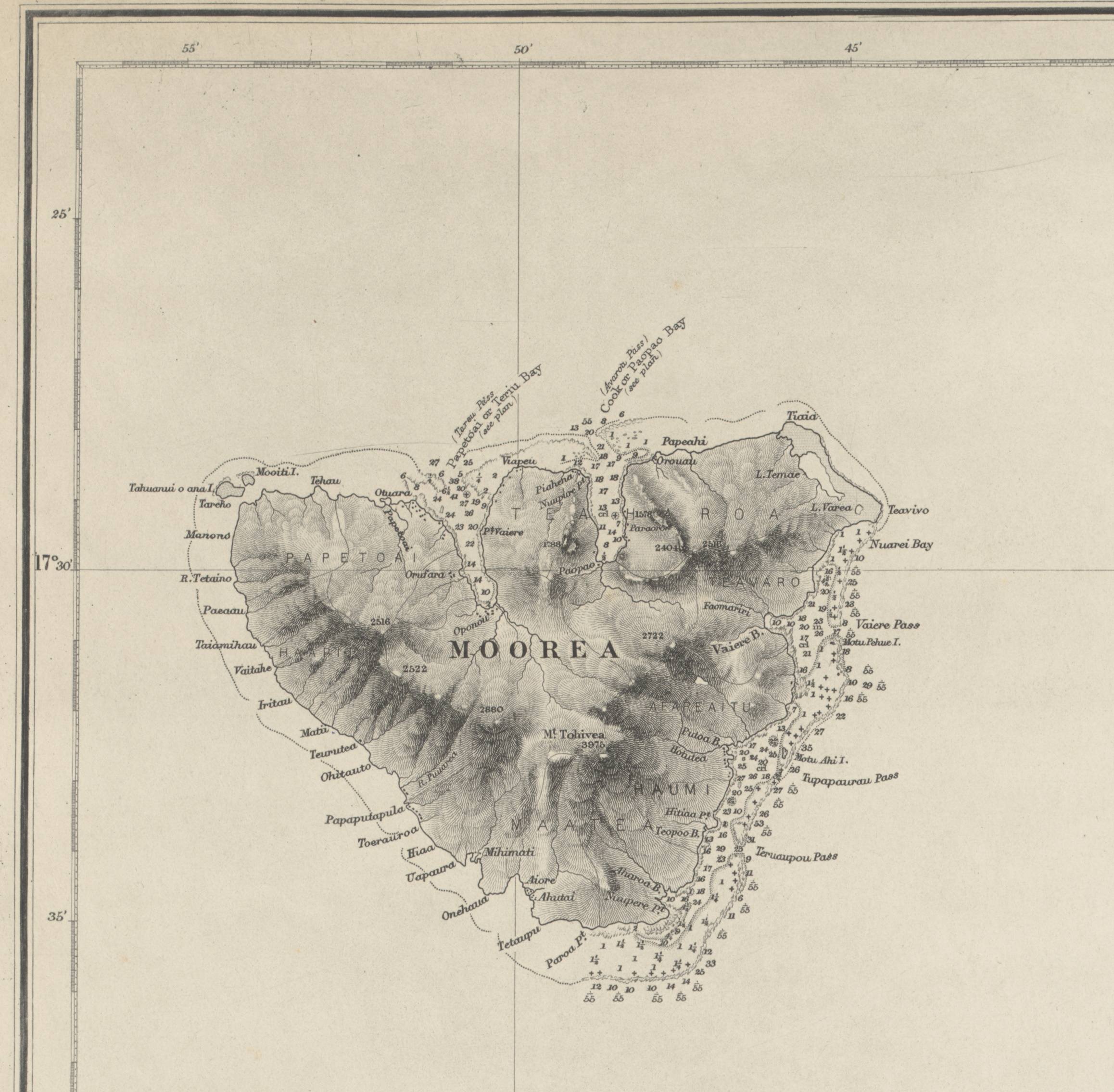
English: Nautical chart of Tahiti and Moorea, with harbours and anchorages on the north coast of Tahiti, and Papetoai and Paopao Bays. Surveyed by Lieutenant and Commander A. Mostyn Field, assisted by Lieutenants W.P. Dawson and S.V.C. Messum, H.M.S. Dart 1886. Not current - not to be used for navigation! |
| Date | |
| Source | https://nla.gov.au/nla.obj-231561339 |
| Author | F.J. Evans |
| Other versions |
_Harbours_and_anchorages_on_the_north_coast_of_Tahiti,_Published_1880.jpg)
_Harbours_and_anchorages_on_the_north_coast_of_Tahiti,_Published_1880.jpg&action=edit§ion=1)
Licensing
[edit]_Harbours_and_anchorages_on_the_north_coast_of_Tahiti,_Published_1880.jpg&action=edit§ion=2)
This work created by the United Kingdom Government is in the public domain.
This is because it is one of the following:
HMSO has declared that the expiry of Crown Copyrights applies worldwide (ref: HMSO Email Reply)
|
 |
File history
Click on a date/time to view the file as it appeared at that time.
| Date/Time | Thumbnail | Dimensions | User | Comment | |
|---|---|---|---|---|---|
| current | 10:15, 30 August 2020 | | 2,316 × 2,270 (1.51 MB) | Ratzer (talk | contribs) | File:Admiralty Chart No 1382 South Pacific Ocean, Society Islands. Tahiti and Moorea (Otaheitʹe and Eimeo) Harbours and anchorages on the north coast of Tahiti, Published 1880.jpg cropped 72 % horizontally, 81 % vertically using CropTool with lossless mode. |
You cannot overwrite this file.
File usage on Commons
The following page uses this file:
File usage on other wikis
The following other wikis use this file:
- Usage on de.wikipedia.org
_Harbours_and_anchorages_on_the_north_coast_of_Tahiti,_Published_1880.jpg&oldid=848378868)