File:Monumental Building, Court Street and Ohio Avenue, Sidney, OH - 52523320794.jpg
Jump to navigation
Jump to search

Size of this preview: 449 × 599 pixels. Other resolutions: 180 × 240 pixels | 360 × 480 pixels | 576 × 768 pixels | 768 × 1,024 pixels | 1,536 × 2,048 pixels | 2,896 × 3,862 pixels.
Original file (2,896 × 3,862 pixels, file size: 3.28 MB, MIME type: image/jpeg)
Captions
Captions
Add a one-line explanation of what this file represents
Summary
[edit]
| Description |
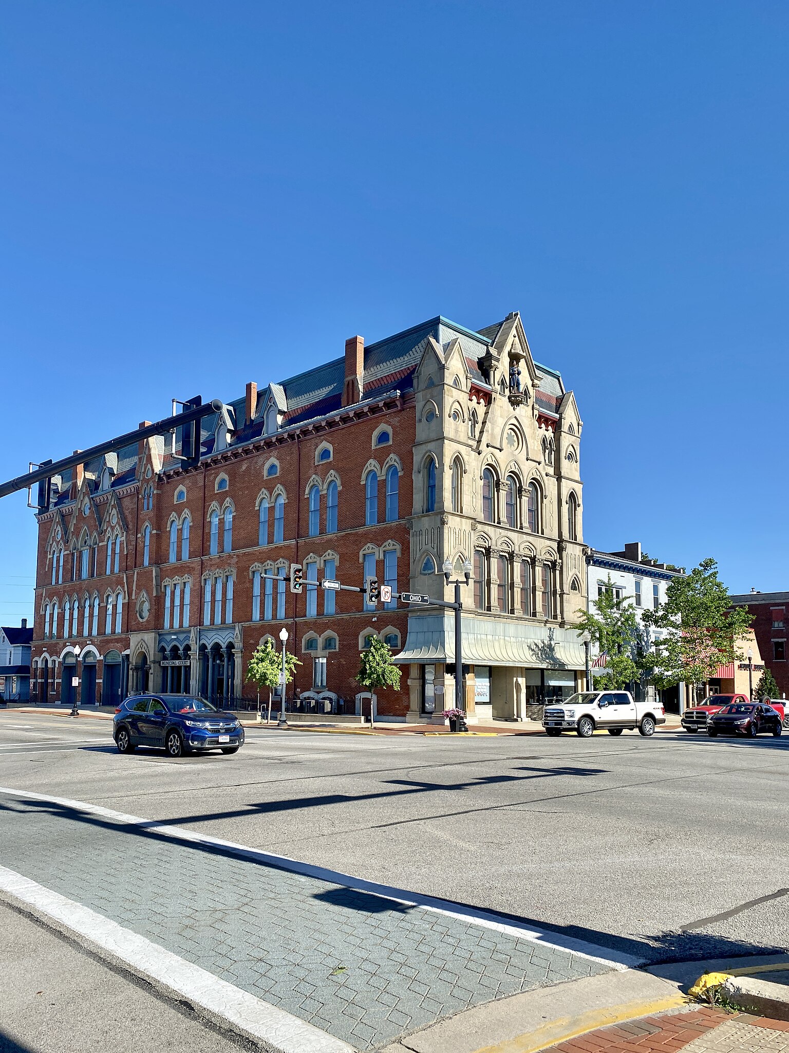
English: Built in 1875-1877, this Gothic Revival-style building was built to house a municipal opera house on the top floor and offices for the City of Sidney, and was dedicated as a memorial to those from Shelby County who had died in the Civil War. The building features a stone-clad front facade and red brick-clad rear and side facades, a mansard roof, steep gables at the dormers and facades, gothic arched two-over-two windows, bracketed cornice, buttresses at the corners with gables at the top, a wall former on the front facade with a statue niche at the top, corinthian pilasters and decorative trim, trifoil windows at the corners of the second floor, oxeye windows at the corners of the fourth floor, gabled dormers, a first floor retail shopfront at the front of the building with stone pilasters and replacement storefronts, a south entrance with a stone surround, oxeye window above, and corinthian engaged columns, garage bays at the west end of the south facade, with three gables above, and recessed storefronts on the south facade with arcades featuring gothic arches and corinthian columns, separated by stone pilasters. The building housed the City of Sidney, the Sidney Police Department, and the Sidney Fire Department until 1939, when the Municipal Building was built on on West Avenue, with the building presently housing the municipal court, along with the offices of the Shelby County Veterans Services. The building is a contributing structure in the Sidney Courthouse Square Historic District, listed on the National Register of Historic Places in 1980. |
| Date | |
| Source | https://www.flickr.com/photos/59081381@N03/52523320794/ |
| Author | w_lemay |
| Camera location | | View this and other nearby images on: OpenStreetMap |
|---|
Licensing
[edit]
This file is licensed under the Creative Commons Attribution-Share Alike 2.0 Generic license.
- You are free:
- to share – to copy, distribute and transmit the work
- to remix – to adapt the work
- Under the following conditions:
- attribution – You must give appropriate credit, provide a link to the license, and indicate if changes were made. You may do so in any reasonable manner, but not in any way that suggests the licensor endorses you or your use.
- share alike – If you remix, transform, or build upon the material, you must distribute your contributions under the same or compatible license as the original.
| This image was originally posted to Flickr by w_lemay at https://flickr.com/photos/59081381@N03/52523320794. It was reviewed on 20 March 2023 by FlickreviewR 2 and was confirmed to be licensed under the terms of the cc-by-sa-2.0. |
File history
Click on a date/time to view the file as it appeared at that time.
| Date/Time | Thumbnail | Dimensions | User | Comment | |
|---|---|---|---|---|---|
| current | 14:37, 20 March 2023 | | 2,896 × 3,862 (3.28 MB) | Ser Amantio di Nicolao (talk | contribs) | Uploaded a work by w_lemay from https://www.flickr.com/photos/59081381@N03/52523320794/ with UploadWizard |
You cannot overwrite this file.
File usage on Commons
There are no pages that use this file.