File:Monument Louis Comte E.jpg
Jump to navigation
Jump to search

Size of this preview: 800 × 533 pixels. Other resolutions: 320 × 213 pixels | 640 × 427 pixels | 1,024 × 683 pixels | 1,280 × 853 pixels | 2,560 × 1,707 pixels | 5,396 × 3,598 pixels.
Original file (5,396 × 3,598 pixels, file size: 16.6 MB, MIME type: image/jpeg)
Captions
Captions
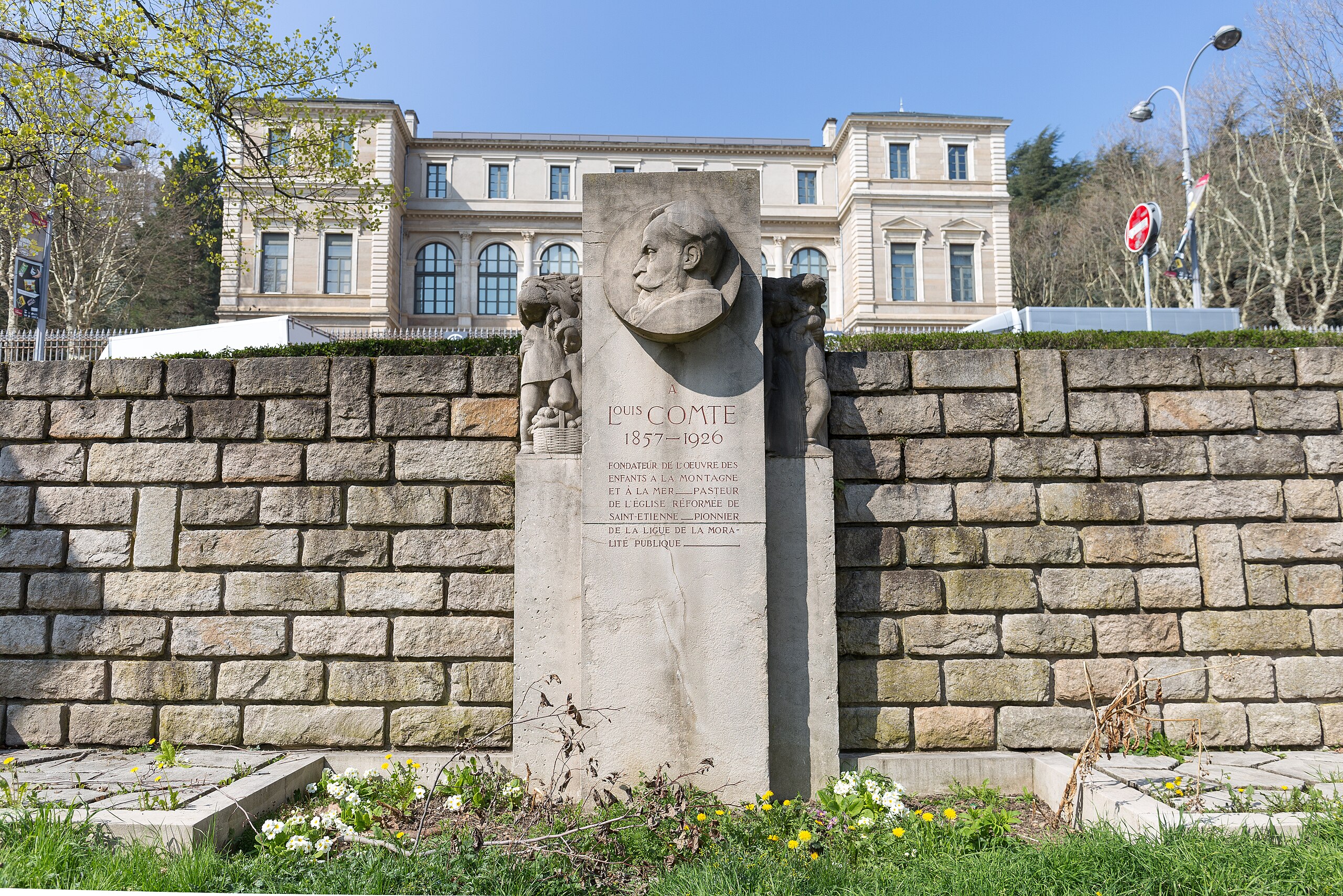
Monument to Louis Comte, Alfred Rochette's work, inaugurated in 1931. Place Louis Comte, Saint-Étienne.
Summary
[edit]| Description |
Français : Monument à Louis Comte, œuvre d'Alfred Rochette, inauguré en 1931. Place Louis Comte, Saint-Étienne.
L'inscription indique : "Fondateur de l'œuvre des enfants à la montagne et à la mer — Pasteur de l'église réformée de Saint-Étienne — Pionnier de la ligue de la moralité publique."
English: Monument to Louis Comte, Alfred Rochette's work, inaugurated in 1931. Place Louis Comte, Saint-Étienne.
The inscription indicates: "Founder of the work of children in the mountains and at the sea - Pastor of the Reformed Church of Saint-Etienne - Pioneer of the league of public morality." |
| Date | |
| Source | Own work |
| Author | Hélène Rival |
| Permission (Reusing this file) |
This file is licensed under the Creative Commons Attribution-Share Alike 4.0 International license. Attribution: Wikimedia Commons : Hélène Rival
|
| Other versions |
|


| Camera location | | View this and other nearby images on: OpenStreetMap |
|---|
File history
Click on a date/time to view the file as it appeared at that time.
| Date/Time | Thumbnail | Dimensions | User | Comment | |
|---|---|---|---|---|---|
| current | 10:35, 16 April 2019 | | 5,396 × 3,598 (16.6 MB) | MirandaAdramin (talk | contribs) | User created page with UploadWizard |
You cannot overwrite this file.
File usage on Commons
The following 2 pages use this file:
File usage on other wikis
The following other wikis use this file:
- Usage on fr.wikipedia.org