File:Montesquieu-Avantès - 20150924 (1).jpg
Jump to navigation
Jump to search

Size of this preview: 800 × 600 pixels. Other resolutions: 320 × 240 pixels | 640 × 480 pixels | 1,024 × 768 pixels | 1,280 × 960 pixels | 2,560 × 1,920 pixels | 3,648 × 2,736 pixels.
Original file (3,648 × 2,736 pixels, file size: 5.76 MB, MIME type: image/jpeg)
Captions
Captions
Add a one-line explanation of what this file represents
Summary
[edit].jpg&action=edit§ion=1)
| Description |
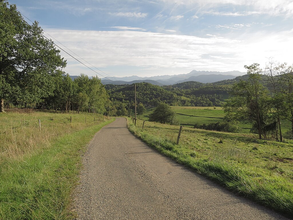
English: Montesquieu-Avantès (Ariège, Midi-Pyrénées, France) - An end-of-afternoon view of the pyrenean foothills in Ariège. (link to googlemaps' street camera -> View south from the road to Férrié, a hamlet located a good mile north of Montesquieu). The hamlet of Audoubert is on the right of the electric pole near the road and of the end of the portion of road seen here; we can see two of its outside buildings, possible two small barns. It stands at the foot af a rather pointed-top steep hill; behind that hill on the left (on its S-E side), also at its foot (unseen here), is the cave of Tuc d'Audoubert. Further away, we can see a few buildings from the village (Montesquieu) behind that same hill on its right (about level with its mid-slope right side). On the horizon, the highest peak is Mont Valier (alt. 2 838 m / 9,311 ft).
Français : Montesquieu-Avantès (Ariège, Midi-Pyrénées, France) - La campagne du piémont pyrénéen ariégeois. Vue vers le sud depuis la route de Férrié (hameau à 1,8 km au nord de Montesquieu, juste derrière nous). Le hameau d'Audoubert se trouve presque dans l'axe de la route, au pied du mont le plus proche (profil du sommet assez pointu) ; on en voit deux petites granges à la lisière des bois, légèrement à droite du poteau électrique et du bout de route vu ici. La grotte du Tuc d'Audoubert est au pied du flanc sud-est de ce premier mont (c'est-à-dire ici derrière le mont sur la gauche). Plus loin, on aperçoit quelques bâtiments du village de Montesquieu derrière le mont à sa droite (à peu près à mi-hauteur du mont). A l'horizon, le plus haut sommet est le Mont Valier (2 838 m d'alt.). |
| Date | Taken on 24 September 2015, 18:05:49 |
| Source | Self-photographed |
| Author | Olybrius |
| Camera location | | View this and other nearby images on: OpenStreetMap |
|---|
.jpg¶ms=043.038592_N_0001.202383_E_globe:Earth_type:camera__&language=en)
Licensing
[edit].jpg&action=edit§ion=2)
I, the copyright holder of this work, hereby publish it under the following license:
This file is licensed under the Creative Commons Attribution-Share Alike 4.0 International license.
- You are free:
- to share – to copy, distribute and transmit the work
- to remix – to adapt the work
- Under the following conditions:
- attribution – You must give appropriate credit, provide a link to the license, and indicate if changes were made. You may do so in any reasonable manner, but not in any way that suggests the licensor endorses you or your use.
- share alike – If you remix, transform, or build upon the material, you must distribute your contributions under the same or compatible license as the original.
File history
Click on a date/time to view the file as it appeared at that time.
| Date/Time | Thumbnail | Dimensions | User | Comment | |
|---|---|---|---|---|---|
| current | 16:06, 27 September 2015 | | 3,648 × 2,736 (5.76 MB) | Olybrius (talk | contribs) | User created page with UploadWizard |
You cannot overwrite this file.
File usage on Commons
The following page uses this file:
- File:Montesquieu-Avantès - 20150925 (3).JPG (file redirect)
.JPG&redirect=no)
File usage on other wikis
The following other wikis use this file:
- Usage on fr.wikipedia.org
.jpg&oldid=824747926)