File:Montage of Telangana State.jpg
Jump to navigation
Jump to search

Size of this preview: 303 × 599 pixels. Other resolutions: 121 × 240 pixels | 243 × 480 pixels | 791 × 1,563 pixels.
Original file (791 × 1,563 pixels, file size: 1.08 MB, MIME type: image/jpeg)
Captions
Captions
Add a one-line explanation of what this file represents
Summary
[edit]
| Description |
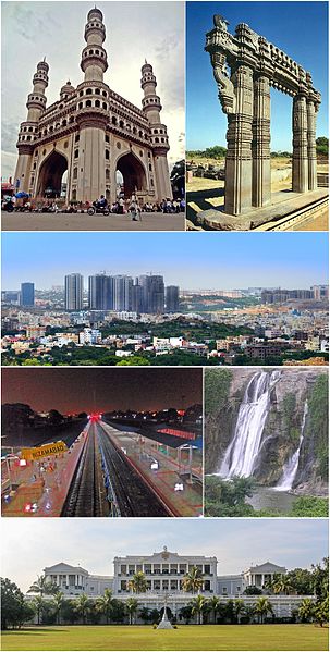
English: Montage of Telangana sidewise from left: Charminar, Warangal Fort, Hyderabad city, Nizamabad Railway Station, Kuntala Waterfalls, Falaknuma Palace |
| Date | |
| Source | Free images from Wikipedia |
| Author |
Side wise -
Original Images |
| Camera location | | View this and other nearby images on: OpenStreetMap |
|---|
Licensing
[edit]
This file is licensed under the Creative Commons Attribution-Share Alike 4.0 International license.
- You are free:
- to share – to copy, distribute and transmit the work
- to remix – to adapt the work
- Under the following conditions:
- attribution – You must give appropriate credit, provide a link to the license, and indicate if changes were made. You may do so in any reasonable manner, but not in any way that suggests the licensor endorses you or your use.
- share alike – If you remix, transform, or build upon the material, you must distribute your contributions under the same or compatible license as the original.
File history
Click on a date/time to view the file as it appeared at that time.
| Date/Time | Thumbnail | Dimensions | User | Comment | |
|---|---|---|---|---|---|
| current | 13:57, 10 September 2015 | | 791 × 1,563 (1.08 MB) | Rizwanmahai (talk | contribs) | User created page with UploadWizard |
You cannot overwrite this file.
File usage on Commons
The following 37 pages use this file:
- తెలంగాణ
- Category:Airports in Telangana
- Category:Archaeological sites in Telangana
- Category:Births in Telangana
- Category:Bodies of water in Telangana
- Category:Bridges in Telangana
- Category:Bus stations in Telangana
- Category:Dams in Telangana
- Category:Districts of Telangana
- Category:Festivals of Telangana
- Category:Film directors from Telangana
- Category:Forts in Telangana
- Category:Geography of Telangana
- Category:Hills of Telangana
- Category:Hindu temples in Telangana
- Category:Hospitals in Telangana
- Category:Jain temples in Telangana
- Category:Lakes of Telangana
- Category:Mandals of Telangana
- Category:Maps of Telangana
- Category:Palaces in Telangana
- Category:People of Telangana
- Category:Populated places in Telangana
- Category:Postcards of Telangana
- Category:Power plants in Telangana
- Category:Rail transport in Telangana
- Category:Railway junction stations in Telangana
- Category:Railway stations in Telangana
- Category:Reservoirs in Telangana
- Category:Rivers of Telangana
- Category:Roads in Telangana
- Category:Shiva temples in Telangana
- Category:Telangana
- Category:Temples in Telangana
- Category:Transport in Telangana
- Category:Villages in Telangana
- Category:Waterfalls in Telangana
File usage on other wikis
The following other wikis use this file:
- Usage on az.wikipedia.org
- Usage on ceb.wikipedia.org
- Usage on es.wikipedia.org
- Usage on gn.wikipedia.org
- Usage on hi.wikipedia.org
- Usage on id.wikipedia.org
- Usage on it.wikivoyage.org
- Usage on mni.wikipedia.org
- Usage on mzn.wikipedia.org
- Usage on ro.wikipedia.org
- Usage on sat.wikipedia.org
- Usage on sd.wikipedia.org
- Usage on sv.wikipedia.org
- Usage on sw.wikipedia.org
- Usage on ta.wikipedia.org
- Usage on te.wikipedia.org
- Usage on th.wikipedia.org
- Usage on tl.wikipedia.org
- Usage on tr.wikipedia.org
- Usage on tt.wikipedia.org
- Usage on war.wikipedia.org
- Usage on www.wikidata.org
- Usage on yi.wikipedia.org