File:Monrovia, Liberia - panoramio (94).jpg
Jump to navigation
Jump to search

Size of this preview: 800 × 533 pixels. Other resolutions: 320 × 213 pixels | 640 × 427 pixels | 1,024 × 683 pixels | 1,280 × 853 pixels | 2,560 × 1,706 pixels | 3,989 × 2,659 pixels.
Original file (3,989 × 2,659 pixels, file size: 1.32 MB, MIME type: image/jpeg)
Captions
Captions
Add a one-line explanation of what this file represents
Summary
[edit].jpg&action=edit§ion=1)
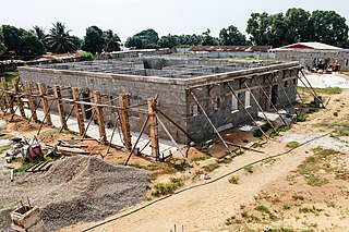
| Description | Monrovia, Liberia | ||
| Date | Taken on 7 January 2014 | ||
| Source | https://web.archive.org/web/20161028220507/http://www.panoramio.com/photo/102730255 | ||
| Author | blk24ga | ||
| Permission (Reusing this file) |
This file is licensed under the Creative Commons Attribution 3.0 Unported license. Attribution: blk24ga
|
||
| Tags (from Panoramio photo page) | Monrovia, 2014, Africa, african, airline, beach, best, Bridge, cars beach, Chimps, church, Church in Lofa Liberia, delta, delta airlines, Fendel, Fish, food, freeport monrovia, Grand Bassa, Grand Bassa County Liberia, Greater Monrovia, Harbel, Harper, hospital, Hospital, Hotel, house, Housing, Liberia, Liberia Monrovia Africa Capital Hill, Liberia Monrovia Congotown Africa, Liberian Coast, Liberian Police, lights, low income, Margibi, Marshall Island, Ministry of Health, Missions, monrovia, Montserrado, National Geographics, night, Paynesville, Roberts-Field Airport Liberia, Robertsport, Royal Hotel @ Monrovia, school, Sinkor, street, Total Gas company In Liberia, tour, Travel, united nations, United States, west africa |
| Camera location | | View this and other nearby images on: OpenStreetMap |
|---|
.jpg¶ms=006.294141_N_-010.791492_E_globe:Earth_type:camera_source:Panoramio_&language=en)
File history
Click on a date/time to view the file as it appeared at that time.
| Date/Time | Thumbnail | Dimensions | User | Comment | |
|---|---|---|---|---|---|
| current | 13:00, 16 March 2017 | | 3,989 × 2,659 (1.32 MB) | Panoramio upload bot (talk | contribs) | == {{int:filedesc}} == {{Information |description=Monrovia, Liberia |date={{Taken on|2014-01-07}} |source=http://www.panoramio.com/photo/102730255 |author=[http://www.panoramio.com/user/6465408?with_photo_id=102730255 blk24ga] |permission={{cc-by-3.0|b... |
You cannot overwrite this file.
File usage on Commons
There are no pages that use this file.
.jpg&oldid=764703011)