File:Monasterio de Santa María la Real de Valdeiglesias.jpg
From Wikimedia Commons, the free media repository
Jump to navigation
Jump to search
Size of this preview: 800 × 427 pixels. Other resolutions: 320 × 171 pixels | 640 × 341 pixels | 1,024 × 546 pixels | 1,280 × 683 pixels | 3,008 × 1,605 pixels.
Original file (3,008 × 1,605 pixels, file size: 1.48 MB, MIME type: image/jpeg)
File information
Structured data
Captions
Summary
[edit]DescriptionMonasterio de Santa María la Real de Valdeiglesias.jpg |
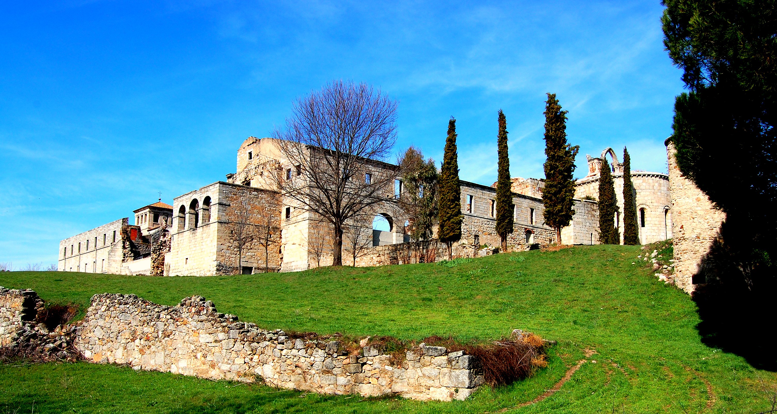
English: Ruins of the 12th Century monastery. |
||
Date | |||
Source | Flickr: Monasterio de Santa María la Real de Valdeiglesias | ||
Author | Arturo R Montesinos | ||
Permission (Reusing this file) |
This file is licensed under the Creative Commons Attribution-Share Alike 2.0 Generic license.
|
||
Other versions |
|
Camera location | 40° 21′ 55.74″ N, 4° 19′ 16.2″ W | View this and other nearby images on: OpenStreetMap | 40.365483; -4.321167 |
---|
File history
Click on a date/time to view the file as it appeared at that time.
Date/Time | Thumbnail | Dimensions | User | Comment | |
---|---|---|---|---|---|
current | 22:15, 20 March 2014 | 3,008 × 1,605 (1.48 MB) | Flickr upload bot (talk | contribs) | Uploaded from http://flickr.com/photo/9905778@N05/3347058194 using Flickr upload bot |
You cannot overwrite this file.
File usage on Commons
The following page uses this file:
File usage on other wikis
The following other wikis use this file:
- Usage on ast.wikipedia.org
- Usage on de.wikipedia.org
- Usage on en.wikipedia.org
- Usage on es.wikipedia.org
Metadata
This file contains additional information such as Exif metadata which may have been added by the digital camera, scanner, or software program used to create or digitize it. If the file has been modified from its original state, some details such as the timestamp may not fully reflect those of the original file. The timestamp is only as accurate as the clock in the camera, and it may be completely wrong.
Camera manufacturer | NIKON CORPORATION |
---|---|
Camera model | NIKON D40 |
Exposure time | 1/400 sec (0.0025) |
F-number | f/10 |
ISO speed rating | 200 |
Date and time of data generation | 11:50, 11 March 2009 |
Lens focal length | 18 mm |
Latitude | 40° 21′ 55.74″ N |
Longitude | 4° 19′ 16.2″ W |
Altitude | 541 meters above sea level |
Horizontal resolution | 300 dpi |
Vertical resolution | 300 dpi |
Software used | picnik.com |
File change date and time | 11:50, 11 March 2009 |
Y and C positioning | Centered |
Exposure Program | Not defined |
Exif version | 2.21 |
Date and time of digitizing | 11:50, 11 March 2009 |
Meaning of each component |
|
Image compression mode | 4 |
APEX exposure bias | 0 |
Maximum land aperture | 3.614709851552 APEX (f/3.5) |
Metering mode | Pattern |
Light source | Unknown |
Flash | Flash did not fire, compulsory flash suppression |
DateTime subseconds | 40 |
DateTimeOriginal subseconds | 40 |
DateTimeDigitized subseconds | 40 |
Supported Flashpix version | 1 |
Color space | sRGB |
Sensing method | One-chip color area sensor |
File source | Digital still camera |
Scene type | A directly photographed image |
Custom image processing | Normal process |
Exposure mode | Auto exposure |
White balance | Auto white balance |
Digital zoom ratio | 1 |
Focal length in 35 mm film | 27 mm |
Scene capture type | Standard |
Scene control | None |
Contrast | Normal |
Saturation | Normal |
Sharpness | Normal |
Subject distance range | Unknown |
GPS time (atomic clock) | 10:47 |
Geodetic survey data used | WGS-84 |
GPS date | 2009:3:11 |
GPS tag version | 2.0.0.0 |