File:Moers graafschap.jpg
Jump to navigation
Jump to search
No higher resolution available.
Moers_graafschap.jpg (606 × 439 pixels, file size: 426 KB, MIME type: image/jpeg)
Captions
Captions
Add a one-line explanation of what this file represents
Summary
[edit]
| Description |
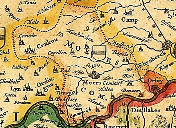
English: Part of Map of "Coloniensis archiepiscopatus" from atlas "Gallia belgica rhenana inferior" representing County Moers, Germany
Nederlands: Kaartdeel van "Coloniensis archiepiscopatus" uit atlas "Gallia belgica rhenana inferior" representatie van het Graafschap Moers, Duitsland 1633 |
| Date | |
| Source | Universiteitsbibliotheek Bern |
| Author | Henricum Hondium |
Licensing
[edit]
|
This work is in the public domain in its country of origin and other countries and areas where the copyright term is the author's life plus 100 years or fewer. | |
| This file has been identified as being free of known restrictions under copyright law, including all related and neighboring rights. | |
File history
Click on a date/time to view the file as it appeared at that time.
| Date/Time | Thumbnail | Dimensions | User | Comment | |
|---|---|---|---|---|---|
| current | 03:12, 8 July 2009 | | 606 × 439 (426 KB) | Arch (talk | contribs) | {{Information |Description={{en|1=Part of Map of "Coloniensis archiepiscopatus" from atlas "Gallia belgica rhenana inferior" representing County Moers, Germany 1633}} {{nl|1=Kaartdeel van "Coloniensis archiepiscopatus" uit atlas "Gallia belgica rhenana in |
You cannot overwrite this file.
File usage on Commons
The following page uses this file:
File usage on other wikis
The following other wikis use this file:
- Usage on bg.wikipedia.org
- Usage on de.wikipedia.org
- Usage on eo.wikipedia.org
- Usage on lb.wikipedia.org