File:Modern house beneath Caher - geograph.org.uk - 450020.jpg
Jump to navigation
Jump to search
No higher resolution available.
Modern_house_beneath_Caher_-_geograph.org.uk_-_450020.jpg (640 × 427 pixels, file size: 133 KB, MIME type: image/jpeg)
Captions
Captions
Add a one-line explanation of what this file represents
Summary
[edit]
| Description |
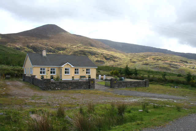
English: Modern house beneath Caher This image typifies the effects of the loose planning laws on this area, which allow a brightly painted modern house to be built in countryside by the Kerry Way under Caher (Cathair). The marshland to the immediate north also carried a notice of a planning application to construct a similar house |
| Date | |
| Source | From geograph.org.uk |
| Author | Espresso Addict |
| Attribution (required by the license) | Espresso Addict / Modern house beneath Caher / |
| Camera location | | View this and other nearby images on: OpenStreetMap |
|---|
_heading:90.00&language=en)
| Object location | | View this and other nearby images on: OpenStreetMap |
|---|
_heading:90.00&language=en)
Licensing
[edit]

|
This image was taken from the Geograph project collection. See this photograph's page on the Geograph website for the photographer's contact details. The copyright on this image is owned by Espresso Addict and is licensed for reuse under the Creative Commons Attribution-ShareAlike 2.0 license.
|
This file is licensed under the Creative Commons Attribution-Share Alike 2.0 Generic license.
Attribution: Espresso Addict
- You are free:
- to share – to copy, distribute and transmit the work
- to remix – to adapt the work
- Under the following conditions:
- attribution – You must give appropriate credit, provide a link to the license, and indicate if changes were made. You may do so in any reasonable manner, but not in any way that suggests the licensor endorses you or your use.
- share alike – If you remix, transform, or build upon the material, you must distribute your contributions under the same or compatible license as the original.
File history
Click on a date/time to view the file as it appeared at that time.
| Date/Time | Thumbnail | Dimensions | User | Comment | |
|---|---|---|---|---|---|
| current | 15:34, 4 February 2011 | | 640 × 427 (133 KB) | GeographBot (talk | contribs) | == {{int:filedesc}} == {{Information |description={{en|1=Modern house beneath Caher This image typifies the effects of the loose planning laws on this area, which allow a brightly painted modern house to be built in countryside by the Kerry Way under Cahe |
You cannot overwrite this file.
File usage on Commons
There are no pages that use this file.