File:Modern Day Location of Braich-y-Dinas, Comparison Image.jpg
Jump to navigation
Jump to search

Size of this preview: 771 × 600 pixels. Other resolutions: 309 × 240 pixels | 617 × 480 pixels | 987 × 768 pixels | 1,280 × 996 pixels | 1,492 × 1,161 pixels.
Original file (1,492 × 1,161 pixels, file size: 535 KB, MIME type: image/jpeg)
Captions
Captions
Add a one-line explanation of what this file represents
Summary
[edit]
| Description |
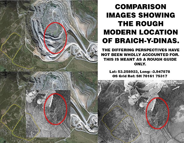
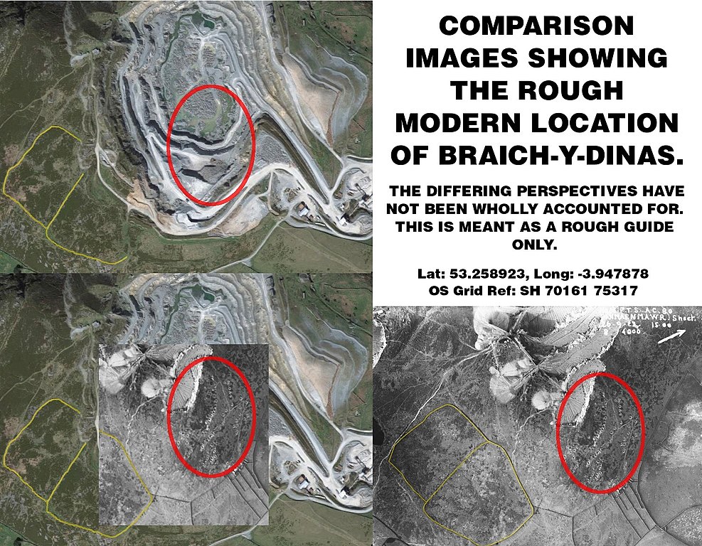
English: Comparison between 1923 aerial photograph of site, with modern day satellite imagery. |
| Date | |
| Source | Royal Commission on the Ancient and Historical Monuments in Wales, Google Maps. |
| Author |
Crown Copyright: Royal Commission on the Ancient and Historical Monuments of Wales: Catalogue reference C455950, reproduced under the Non-Commercial Government Licence. http://www.nationalarchives.gov.uk/doc/non-commercial-government-licence/non-commercial-government-licence.htm Imagery 2017 Google, Map Data 2017 Google, United Kingdom. |
Licensing
[edit]
This file is licensed under the Creative Commons Attribution 4.0 International license.
- You are free:
- to share – to copy, distribute and transmit the work
- to remix – to adapt the work
- Under the following conditions:
- attribution – You must give appropriate credit, provide a link to the license, and indicate if changes were made. You may do so in any reasonable manner, but not in any way that suggests the licensor endorses you or your use.
File history
Click on a date/time to view the file as it appeared at that time.
| Date/Time | Thumbnail | Dimensions | User | Comment | |
|---|---|---|---|---|---|
| current | 19:00, 7 October 2017 | | 1,492 × 1,161 (535 KB) | Telenarn (talk | contribs) | User created page with UploadWizard |
You cannot overwrite this file.
File usage on Commons
There are no pages that use this file.
File usage on other wikis
The following other wikis use this file:
- Usage on cy.wikipedia.org
- Usage on en.wikipedia.org
- Usage on www.wikidata.org