File:Mitchell Bruce R-- Shark Bay salt lakes.jpg
Jump to navigation
Jump to search
Size of this preview: 800 × 533 pixels. Other resolutions: 320 × 213 pixels | 640 × 427 pixels | 1,024 × 683 pixels | 1,280 × 853 pixels | 2,560 × 1,707 pixels | 5,616 × 3,744 pixels.
Original file (5,616 × 3,744 pixels, file size: 12.66 MB, MIME type: image/jpeg)
Captions
Captions
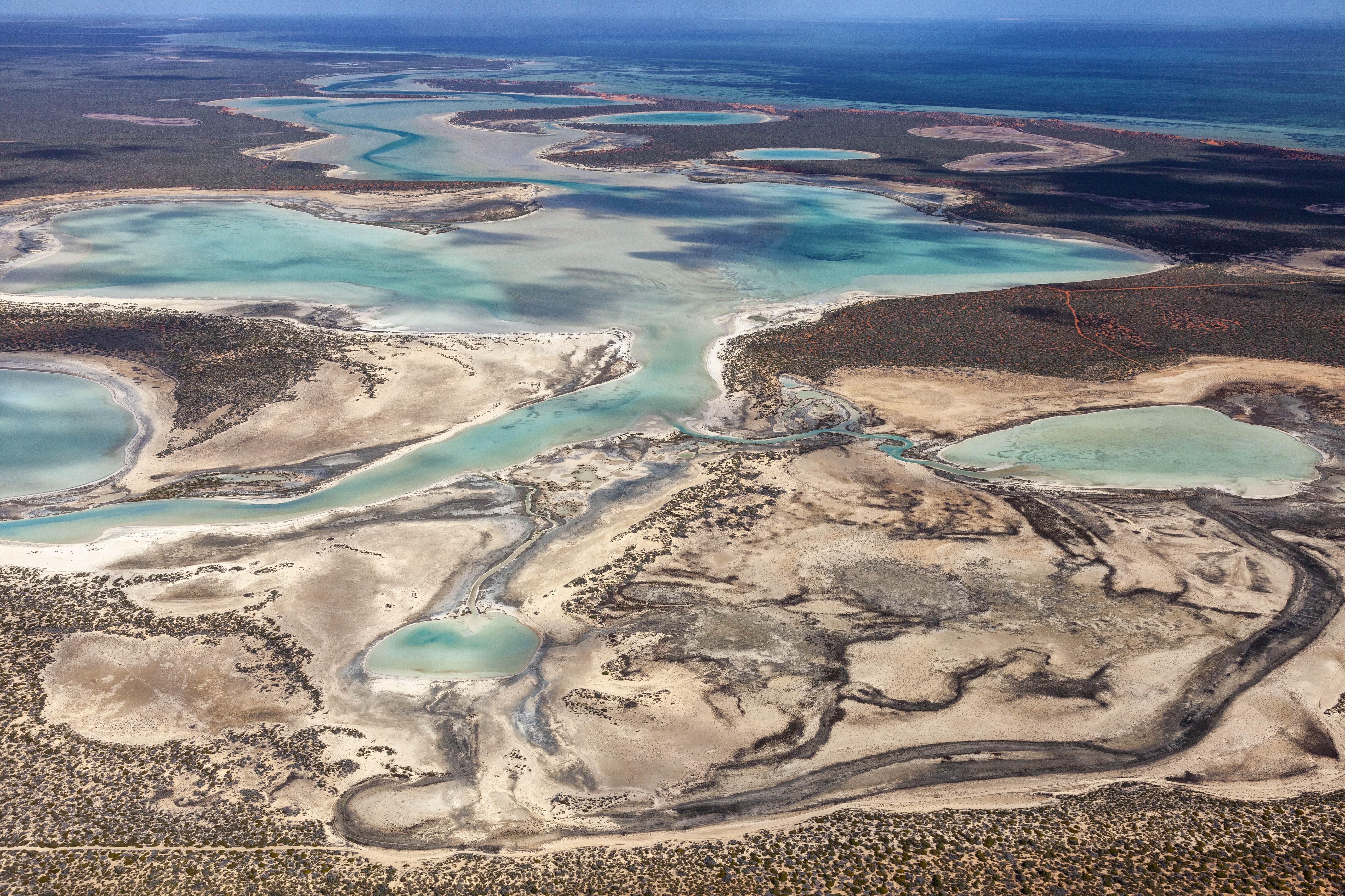
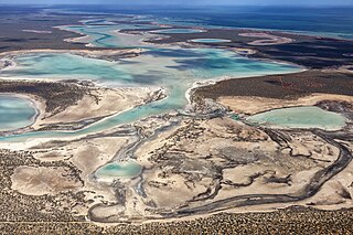
Despite being adjacent to the Indian Ocean with poor soils, extremes of heat and salinity, some plants in the Shark Bay region survive.
Summary
[edit]
| Description |
English: Francois Perron NP is a dry and very hot region where heat and high salinity determine the fate of everything. Small bushes and scrubby plants form intricate patterns and textures that are best viewed from above. |
| Date | |
| Source | Own work |
| Author | Bruce R. Mitchell |
| Camera location | | View this and other nearby images on: OpenStreetMap |
|---|
Licensing
[edit]
I, the copyright holder of this work, hereby publish it under the following license:
This file is licensed under the Creative Commons Attribution-Share Alike 4.0 International license.
- You are free:
- to share – to copy, distribute and transmit the work
- to remix – to adapt the work
- Under the following conditions:
- attribution – You must give appropriate credit, provide a link to the license, and indicate if changes were made. You may do so in any reasonable manner, but not in any way that suggests the licensor endorses you or your use.
- share alike – If you remix, transform, or build upon the material, you must distribute your contributions under the same or compatible license as the original.
File history
Click on a date/time to view the file as it appeared at that time.
| Date/Time | Thumbnail | Dimensions | User | Comment | |
|---|---|---|---|---|---|
| current | 21:18, 27 May 2019 | | 5,616 × 3,744 (12.66 MB) | Brucepython (talk | contribs) | User created page with UploadWizard |
You cannot overwrite this file.
File usage on Commons
There are no pages that use this file.
File usage on other wikis
The following other wikis use this file:
- Usage on de.wikipedia.org
- Usage on ko.wikipedia.org
- Usage on ru.wikipedia.org