File:Minie Ball House.jpg
Jump to navigation
Jump to search

Size of this preview: 800 × 600 pixels. Other resolutions: 320 × 240 pixels | 640 × 480 pixels | 1,024 × 768 pixels | 1,280 × 960 pixels | 2,560 × 1,920 pixels | 3,072 × 2,304 pixels.
Original file (3,072 × 2,304 pixels, file size: 2.88 MB, MIME type: image/jpeg)
Captions
Captions
Add a one-line explanation of what this file represents
|
This is an image of a place or building that is listed on the National Register of Historic Places in the United States of America. Its reference number is 98001608. |
| Camera location | | View this and other nearby images on: OpenStreetMap |
|---|
| Description |
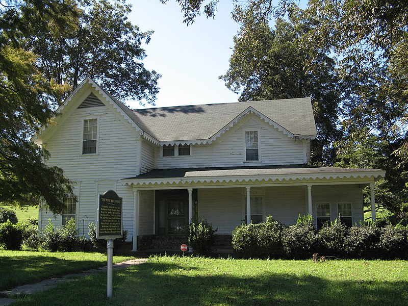
English: Front of the Minie Ball House, located on the northern side of the 300 block of Second Street in Friars Point, Mississippi, United States. Built in 1850, it is part of the Friars Point Historic District, a historic district that is listed on the National Register of Historic Places. |
| Date | Taken on 12 September 2007 |
| Source | Flickr |
| Author | NatalieMaynor |
| Permission (Reusing this file) |
This file is licensed under the Creative Commons Attribution 2.0 Generic license.
|
| This image was originally posted to Flickr by NatalieMaynor at https://www.flickr.com/photos/93178668@N00/1380329725. It was reviewed on 9 February 2010 by FlickreviewR and was confirmed to be licensed under the terms of the cc-by-2.0. |
File history
Click on a date/time to view the file as it appeared at that time.
| Date/Time | Thumbnail | Dimensions | User | Comment | |
|---|---|---|---|---|---|
| current | 16:10, 9 February 2010 | | 3,072 × 2,304 (2.88 MB) | Nyttend (talk | contribs) | {{Location|34|22|25.5|N|90|38|13|W}} {{Information |Description={{en|Front of the Minie Ball House, located on the northern side of the 300 block of Second Street in {{w|Friars Point, Mississippi|Friars Point}}, {{w|Mississippi}}, {{w|United States}}. Bu |
You cannot overwrite this file.
File usage on Commons
There are no pages that use this file.
File usage on other wikis
The following other wikis use this file:
- Usage on de.wikipedia.org
- Usage on en.wikipedia.org
- Usage on es.wikipedia.org
- Usage on fa.wikipedia.org
- Usage on fr.wikipedia.org
- Usage on it.wikipedia.org
- Usage on sh.wikipedia.org
- Usage on sr.wikipedia.org
- Usage on uz.wikipedia.org
Metadata
Categories:
- Houses built in Mississippi in 1850
- Friars Point, Mississippi
- Historic districts in Mississippi (state)
- Historical markers in Mississippi (state)
- Houses on the National Register of Historic Places in Mississippi (state)
- National Register of Historic Places in Coahoma County, Mississippi
- Wooden houses in Mississippi (state)