File:Milwaukee-Racine-Waukesha CSA.png
Jump to navigation
Jump to search
No higher resolution available.
Milwaukee-Racine-Waukesha_CSA.png (434 × 459 pixels, file size: 22 KB, MIME type: image/png)
Captions
Captions
Add a one-line explanation of what this file represents
Summary
[edit]
| Description |
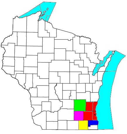
Map of Milwaukee-Racine-Waukesha, WI Combined Statistical Area (CSA):
|
| Date | |
| Source | I modified File:Milwaukee-Waukesha-West Allis Metropolitan Area.png, which was previously modified this United States Census Bureau file by Nyttend. |
| Author | Yassie |
| Permission (Reusing this file) |
US Government work is in public domain, and Nyttend has released his/her work into the public domain, too. I hereby release my work into public domain, too. |
Licensing
[edit]
| I, the copyright holder of this work, release this work into the public domain. This applies worldwide. In some countries this may not be legally possible; if so: I grant anyone the right to use this work for any purpose, without any conditions, unless such conditions are required by law. |
File history
Click on a date/time to view the file as it appeared at that time.
| Date/Time | Thumbnail | Dimensions | User | Comment | |
|---|---|---|---|---|---|
| current | 15:51, 5 November 2014 | | 434 × 459 (22 KB) | Yassie (talk | contribs) | {{Information |Description= |Source= I modified File:Milwaukee-Waukesha-West Allis Metropolitan Area.png, which was previously modified [http://www2.census.gov/geo/maps/general_ref/cousub_outline/cen2k_pgsz/wi_cosub.pdf this] {{w|United States Cen... |
You cannot overwrite this file.
File usage on Commons
There are no pages that use this file.
File usage on other wikis
The following other wikis use this file:
- Usage on www.wikidata.org