File:Millstone River South.JPG
Jump to navigation
Jump to search

Size of this preview: 800 × 466 pixels. Other resolutions: 320 × 186 pixels | 640 × 373 pixels | 1,214 × 707 pixels.
Original file (1,214 × 707 pixels, file size: 481 KB, MIME type: image/jpeg)
Captions
Captions
Add a one-line explanation of what this file represents
Summary
[edit]
| Description |
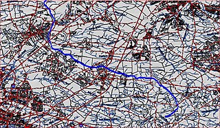
English: Map of southern section of w:Millstone River |
| Date | 14:58, 4 August 2010 (UTC) |
| Source | USGS |
| Author | USGS and Chemicalinterest (talk) |
| Permission (Reusing this file) |
Free map service |
| Other versions | none |
Licensing
[edit]
This image is in the public domain in the United States because it only contains materials that originally came from the United States Geological Survey, an agency of the United States Department of the Interior. For more information, see the official USGS copyright policy.
|
File history
Click on a date/time to view the file as it appeared at that time.
| Date/Time | Thumbnail | Dimensions | User | Comment | |
|---|---|---|---|---|---|
| current | 14:58, 4 August 2010 | | 1,214 × 707 (481 KB) | Chemicalinterest (talk | contribs) | {{Information |Description = Map of southern section of Millstone River |Source = USGS |Date = ~~~~~ |Author = USGS and ~~~ |Permission = Free map service |other_versions = none }} |
You cannot overwrite this file.
File usage on Commons
There are no pages that use this file.
File usage on other wikis
The following other wikis use this file:
- Usage on en.wikipedia.org