File:Millo Geographicae tabulae.jpg
Jump to navigation
Jump to search
No higher resolution available.
Millo_Geographicae_tabulae.jpg (800 × 516 pixels, file size: 95 KB, MIME type: image/jpeg)
Captions
Captions
Add a one-line explanation of what this file represents
Summary
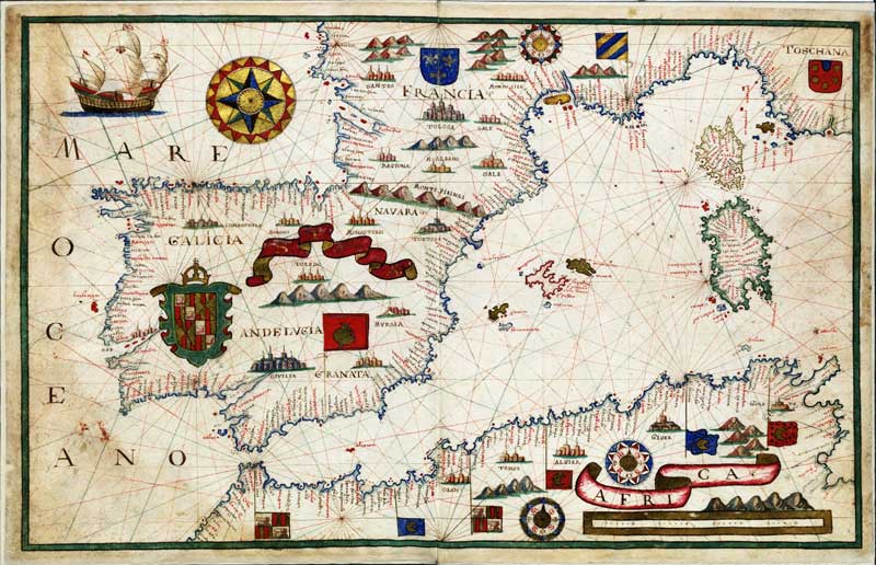
[edit]| Geographicae tabulae in charta pergamena | |
|---|---|
| Author |
Antonio Millo (Antonius Millo) |
| Title |
Geographicae tabulae in charta pergamena |
| Language | Latin |
| Publication date | 1583 |
| Place of publication | Venice |
| English: Map of the Mediterranean Sea.
Polski: Mapa Morza Śródziemnego. ( |
||||||||||||||||||||||||
|---|---|---|---|---|---|---|---|---|---|---|---|---|---|---|---|---|---|---|---|---|---|---|---|---|
| Artist |
Antonio Millo |
|||||||||||||||||||||||
| Title |
English: Map of the Mediterranean Sea.
Polski: Mapa Morza Śródziemnego. |
|||||||||||||||||||||||
| Date | 1583 | |||||||||||||||||||||||
| Medium | ink and color on parchment | |||||||||||||||||||||||
| Dimensions | height: 41 cm (16.1 in); width: 65 cm (25.5 in) | |||||||||||||||||||||||
| Collection |
|
|||||||||||||||||||||||
| Current location |
Warsaw |
|||||||||||||||||||||||
| Accession number |
BN ZZK 0.2399 |
|||||||||||||||||||||||
| Source/Photographer | www.bn.org.pl | |||||||||||||||||||||||
| Permission (Reusing this file) |
Copyright expired, PD-Art | |||||||||||||||||||||||

Licensing
[edit]
|
This is a faithful photographic reproduction of a two-dimensional, public domain work of art. The work of art itself is in the public domain for the following reason:
The official position taken by the Wikimedia Foundation is that "faithful reproductions of two-dimensional public domain works of art are public domain".
This photographic reproduction is therefore also considered to be in the public domain in the United States. In other jurisdictions, re-use of this content may be restricted; see Reuse of PD-Art photographs for details. | ||||
File history
Click on a date/time to view the file as it appeared at that time.
| Date/Time | Thumbnail | Dimensions | User | Comment | |
|---|---|---|---|---|---|
| current | 16:16, 20 January 2011 | | 800 × 516 (95 KB) | BurgererSF (talk | contribs) | {{Information |Description={{en|1=Geographicae tabulae Warsaw}} |Source=web |Author=Millo |Date= |Permission= |other_versions= }} |
You cannot overwrite this file.
File usage on Commons
The following page uses this file:
Metadata
Categories:
- Maps by Antonio Millo
- Cartographic collection in the National Library in Warsaw
- 16th-century maps of the Western Mediterranean
- 1580s maps of the Iberian Peninsula
- Ships on maps
- Coats of arms on maps
- Royal coats of arms of France (modern)
- Compass roses on maps
- Galicia in portolan charts
- 1583 in Galicia (Spain)