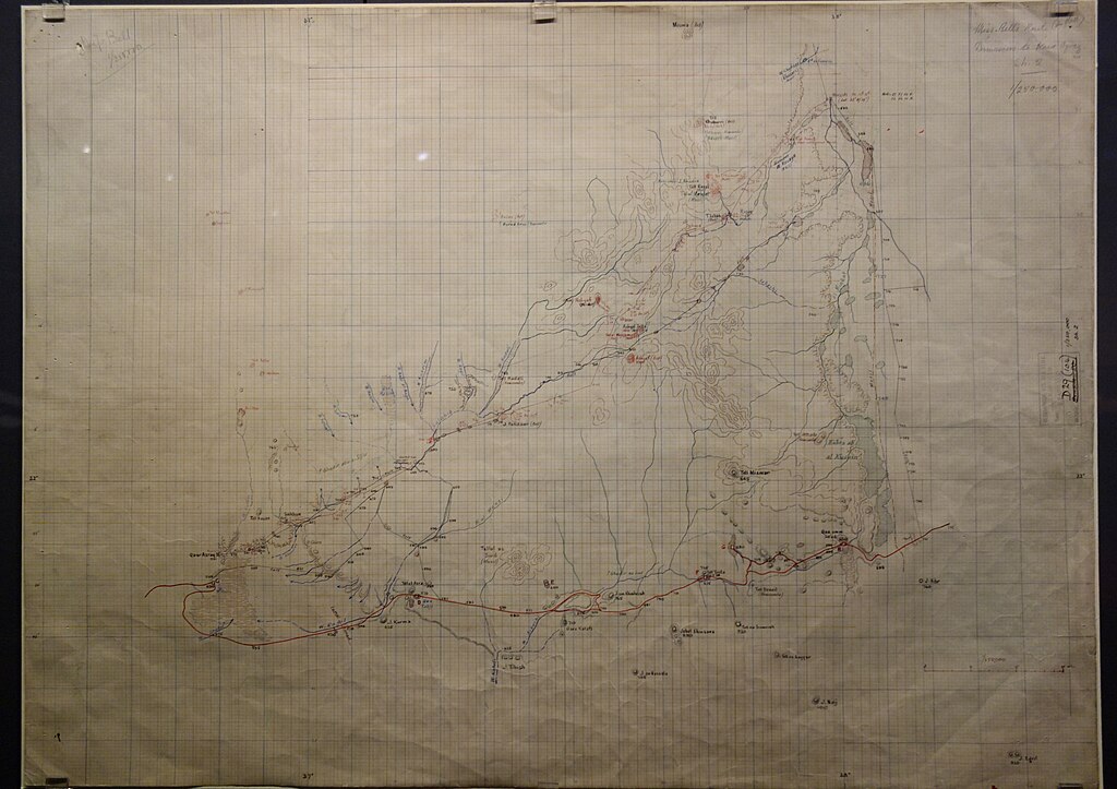
File:Military map of central Arabia based on Gertrude Bell's measurements, with her route in red, by the Intelligence Department MI4, London, 1914-1937 - British Library, London - DSC00542.jpg
Jump to navigation
Jump to search

Size of this preview: 800 × 564 pixels. Other resolutions: 320 × 226 pixels | 640 × 452 pixels | 1,024 × 723 pixels | 1,280 × 903 pixels | 2,560 × 1,806 pixels | 5,170 × 3,648 pixels.
Original file (5,170 × 3,648 pixels, file size: 4.04 MB, MIME type: image/jpeg)
Captions
Captions
Exhibit in the British Library, London, England.
Summary
[edit]
| Description |
English: Exhibit in the British Library, London, England. |
| Date | |
| Source | Own work |
| Author | Daderot |
Licensing
[edit]
I, the copyright holder of this work, hereby publish it under the following license:
| This file is made available under the Creative Commons CC0 1.0 Universal Public Domain Dedication. | |
| The person who associated a work with this deed has dedicated the work to the public domain by waiving all of their rights to the work worldwide under copyright law, including all related and neighboring rights, to the extent allowed by law. You can copy, modify, distribute and perform the work, even for commercial purposes, all without asking permission.
|
File history
Click on a date/time to view the file as it appeared at that time.
| Date/Time | Thumbnail | Dimensions | User | Comment | |
|---|---|---|---|---|---|
| current | 14:26, 20 June 2024 | | 5,170 × 3,648 (4.04 MB) | Daderot (talk | contribs) | Uploaded own work with UploadWizard |
You cannot overwrite this file.
File usage on Commons
There are no pages that use this file.