File:Milestone at Llanllowell - geograph.org.uk - 734700.jpg
Jump to navigation
Jump to search
Size of this preview: 399 × 599 pixels. Other resolutions: 160 × 240 pixels | 426 × 640 pixels.
Original file (426 × 640 pixels, file size: 115 KB, MIME type: image/jpeg)
Captions
Captions
Add a one-line explanation of what this file represents
Summary
[edit]
| Description |
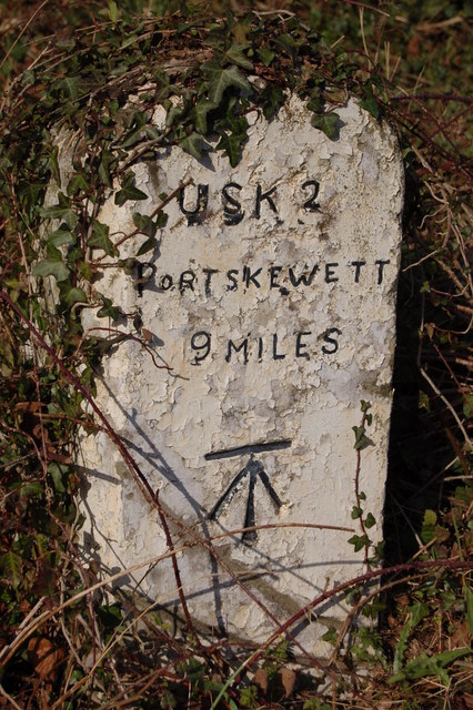
English: Milestone at Llanllowell This milestone on an unclassified road south of Usk has emerged from the undergrowth during the winter. Portskewett is now an insignificant village some 4 miles south-west of Chepstow lying on the western side and between the two Severn road bridges. However, the 'National Gazetteer for Great Britain & Ireland' published in 1868 indicates the former importance of the village to travellers as it was "situated near the Black Rock Inn ferry, on the river Severn, formerly called the New Passage". |
| Date | |
| Source | From geograph.org.uk |
| Author | Roger Davies |
| Attribution (required by the license) | Roger Davies / Milestone at Llanllowell / |
| Camera location | | View this and other nearby images on: OpenStreetMap |
|---|
_heading:22.00&language=en)
| Object location | | View this and other nearby images on: OpenStreetMap |
|---|
_heading:22.00&language=en)
Licensing
[edit]

|
This image was taken from the Geograph project collection. See this photograph's page on the Geograph website for the photographer's contact details. The copyright on this image is owned by Roger Davies and is licensed for reuse under the Creative Commons Attribution-ShareAlike 2.0 license.
|
This file is licensed under the Creative Commons Attribution-Share Alike 2.0 Generic license.
Attribution: Roger Davies
- You are free:
- to share – to copy, distribute and transmit the work
- to remix – to adapt the work
- Under the following conditions:
- attribution – You must give appropriate credit, provide a link to the license, and indicate if changes were made. You may do so in any reasonable manner, but not in any way that suggests the licensor endorses you or your use.
- share alike – If you remix, transform, or build upon the material, you must distribute your contributions under the same or compatible license as the original.
File history
Click on a date/time to view the file as it appeared at that time.
| Date/Time | Thumbnail | Dimensions | User | Comment | |
|---|---|---|---|---|---|
| current | 08:32, 19 February 2011 | | 426 × 640 (115 KB) | GeographBot (talk | contribs) | == {{int:filedesc}} == {{Information |description={{en|1=Milestone at Llanllowell This milestone on an unclassified road south of Usk has emerged from the undergrowth during the winter. Portskewett is now an insignificant village some 4 miles south-west o |
You cannot overwrite this file.
File usage on Commons
There are no pages that use this file.